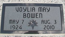
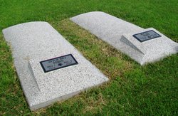
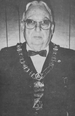
Voylia May O'Brien Bowen
| Birth | : | 7 May 1924 Humboldt, Allen County, Kansas, USA |
| Death | : | 3 Aug 2010 Tulsa, Tulsa County, Oklahoma, USA |
| Burial | : | St. Michael & All Angels Churchyard, Penkridge, South Staffordshire Borough, England |
| Coordinate | : | 52.7245874, -2.1181258 |
| Description | : | ************************** Published Aug. 29, 2010 - Iola, KS Voylia May Bowen, 86, died Tuesday, Aug. 3, 2010, at the home of her daughter, Lia Bowen Franson, in Tulsa, Oklahoma. She was born on May 7, 1924, in Humboldt, Kansas, to George Higginbotham and Hazel Beatrice (Johnston) O'Brien. She graduated from Iola High School, attended Allen County Community Junior College and one semester at Kansas University. She married Rex L. Bowen on June 16, 1945, in Birmingham Alabama. Before marriage she worked as a teletype operator for Delta Airlines. They lived in Harlingen, TX, and later moved to Cushing, OK. In 1999,... Read More |
frequently asked questions (FAQ):
-
Where is Voylia May O'Brien Bowen's memorial?
Voylia May O'Brien Bowen's memorial is located at: St. Michael & All Angels Churchyard, Penkridge, South Staffordshire Borough, England.
-
When did Voylia May O'Brien Bowen death?
Voylia May O'Brien Bowen death on 3 Aug 2010 in Tulsa, Tulsa County, Oklahoma, USA
-
Where are the coordinates of the Voylia May O'Brien Bowen's memorial?
Latitude: 52.7245874
Longitude: -2.1181258
Family Members:
Parent
Spouse
Siblings
Flowers:
Nearby Cemetories:
1. Christ Church
Gailey, South Staffordshire Borough, England
Coordinate: 52.6933900, -2.1308200
2. St. James Churchyard
Acton Trussell, South Staffordshire Borough, England
Coordinate: 52.7546980, -2.0943120
3. Saint John's Churchyard
Stretton, South Staffordshire Borough, England
Coordinate: 52.6999790, -2.1720920
4. All Saints Churchyard
Lapley, South Staffordshire Borough, England
Coordinate: 52.7138900, -2.1902330
5. St. Saviour Churchyard
Hatherton, South Staffordshire Borough, England
Coordinate: 52.6841730, -2.0660840
6. St Mary and All Saints
Bradley, Stafford Borough, England
Coordinate: 52.7599257, -2.1808769
7. Cannock Chase War Cemetery
Cannock, Cannock Chase District, England
Coordinate: 52.7370710, -2.0266340
8. Cannock Chase German Military Cemetery
Cannock, Cannock Chase District, England
Coordinate: 52.7370580, -2.0265050
9. Cannock Cemetery
Cannock, Cannock Chase District, England
Coordinate: 52.7008790, -2.0288950
10. St Mary and St Chad Churchyard
Brewood, South Staffordshire Borough, England
Coordinate: 52.6754850, -2.1738520
11. St. Luke's Churchyard
Cannock, Cannock Chase District, England
Coordinate: 52.6889919, -2.0287352
12. St Mary Roman Catholic Churchyard
Cannock, Cannock Chase District, England
Coordinate: 52.6867620, -2.0283360
13. St. Editha's Parish Church Graveyard
Church Eaton, Stafford Borough, England
Coordinate: 52.7560690, -2.2259540
14. St Giles Churchyard
Haughton, Stafford Borough, England
Coordinate: 52.7817750, -2.2005140
15. Our Lady of Lourdes Churchyard
Hednesford, Cannock Chase District, England
Coordinate: 52.7051311, -1.9969935
16. St. Peter's Churchyard
Hednesford, Cannock Chase District, England
Coordinate: 52.7050630, -1.9918330
17. Cheslyn Hay Cemetery
Cheslyn Hay, South Staffordshire Borough, England
Coordinate: 52.6581170, -2.0431790
18. St. Mary's Churchyard
Stafford, Stafford Borough, England
Coordinate: 52.8057000, -2.1187000
19. St Chad
Stafford, Stafford Borough, England
Coordinate: 52.8061611, -2.1165797
20. St. Mark's Churchyard
Great Wyrley, South Staffordshire Borough, England
Coordinate: 52.6664250, -2.0231955
21. Great Wyrley Cemetery
Great Wyrley, South Staffordshire Borough, England
Coordinate: 52.6642130, -2.0269380
22. Saint Johns Church
Bishops Wood, Shropshire Unitary Authority, England
Coordinate: 52.6810030, -2.2369880
23. St John Churchyard
Heath Hayes, Cannock Chase District, England
Coordinate: 52.6914160, -1.9846280
24. Stafford Crematorium and Burial Ground
Stafford, Stafford Borough, England
Coordinate: 52.8080900, -2.0747420


