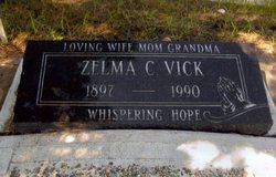
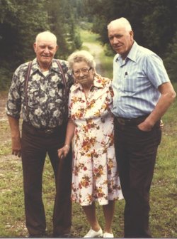
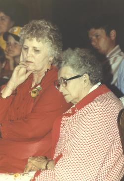
Zelma Christine “Casey” Sanderson Vick
| Birth | : | 8 Mar 1897 Platte, Charles Mix County, South Dakota, USA |
| Death | : | 15 Mar 1990 Fairview, Grande Prairie Census Division, Alberta, Canada |
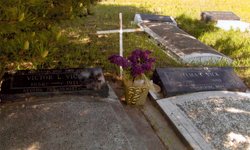
| Burial | : | Preston Old Cemetery, Ribbleton, City of Preston, England |
| Coordinate | : | 53.7686352, -2.6623154 |
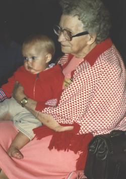
| Description | : | Zelma Christine (Sanderson) Vick Christine Vick, a long-time resident of the Peace River country, died at the Fairview Hospital on March 15, 1990, one week after her 93rd birthday. Her given name was Zelma Christine Sanderson and she was born on her parent's farm at Forbes, South Dakota, USA, on March 8, 1897. The family moved to Canada and settled on a farm near Assinaboia, Saskatchewan, Canada. She met and married Victor Vick in 1918 and their home was in and around this area for eleven years. Two of their four children were born in Saskatchewan. In 1927 they moved to the Peace River... Read More |
frequently asked questions (FAQ):
-
Where is Zelma Christine “Casey” Sanderson Vick's memorial?
Zelma Christine “Casey” Sanderson Vick's memorial is located at: Preston Old Cemetery, Ribbleton, City of Preston, England.
-
When did Zelma Christine “Casey” Sanderson Vick death?
Zelma Christine “Casey” Sanderson Vick death on 15 Mar 1990 in Fairview, Grande Prairie Census Division, Alberta, Canada
-
Where are the coordinates of the Zelma Christine “Casey” Sanderson Vick's memorial?
Latitude: 53.7686352
Longitude: -2.6623154
Family Members:
Parent
Spouse
Siblings
Children
Flowers:
Nearby Cemetories:
1. Preston Old Cemetery
Ribbleton, City of Preston, England
Coordinate: 53.7686352, -2.6623154
2. Preston New Cemetery
Ribbleton, City of Preston, England
Coordinate: 53.7717400, -2.6620900
3. St. Paul Churchyard
Preston, City of Preston, England
Coordinate: 53.7625360, -2.6947080
4. St. Ignatius RC Churchyard
Preston, City of Preston, England
Coordinate: 53.7635270, -2.6965870
5. St Leonard Churchyard
Walton-le-Dale, South Ribble Borough, England
Coordinate: 53.7476530, -2.6666950
6. St Augustine of Canterbury
Preston, City of Preston, England
Coordinate: 53.7560420, -2.6912650
7. St. James' Churchyard
Preston, City of Preston, England
Coordinate: 53.7566010, -2.6941110
8. St John Churchyard
Preston, City of Preston, England
Coordinate: 53.7582080, -2.6959750
9. St. Leonard the Less Churchyard
Samlesbury, South Ribble Borough, England
Coordinate: 53.7680000, -2.6237000
10. Preston Crematorium
Preston, City of Preston, England
Coordinate: 53.7863750, -2.6340170
11. Holy Trinity
Preston, City of Preston, England
Coordinate: 53.7613030, -2.7030580
12. Friends Meeting House Burial Ground (Defunct)
Preston, City of Preston, England
Coordinate: 53.7610250, -2.7030380
13. Christ Church Churchyard
Fulwood, City of Preston, England
Coordinate: 53.7771920, -2.7028700
14. St. George the Martyr
Preston, City of Preston, England
Coordinate: 53.7591220, -2.7025660
15. St. Mary's and St. John RC Churchyard, Southworth
Samlesbury, South Ribble Borough, England
Coordinate: 53.7676690, -2.6183400
16. St. Wilfrid's Catholic Cemetery
Preston, City of Preston, England
Coordinate: 53.7581670, -2.7044930
17. Saint Peter Churchyard
Preston, City of Preston, England
Coordinate: 53.7634100, -2.7080700
18. Grey Friars' Church
Preston, City of Preston, England
Coordinate: 53.7601480, -2.7084600
19. Christ Church Churchyard
Preston, City of Preston, England
Coordinate: 53.7573210, -2.7103080
20. All Saints Churchyard
Walton-le-Dale, South Ribble Borough, England
Coordinate: 53.7407250, -2.6408280
21. Our Lady and St Patrick's Church
Walton-le-Dale, South Ribble Borough, England
Coordinate: 53.7407250, -2.6408280
22. St Walburge's RC Church
Preston, City of Preston, England
Coordinate: 53.7629690, -2.7149620
23. St. Mary's Churchyard
Preston, City of Preston, England
Coordinate: 53.8010830, -2.6779600
24. St. Michael's Churchyard
Grimsargh, City of Preston, England
Coordinate: 53.7990710, -2.6352530

