
| Memorials | : | 43 |
| Location | : | South Cerney, Cotswold District, England |
| Coordinate | : | 51.6748248, -1.9292083 |
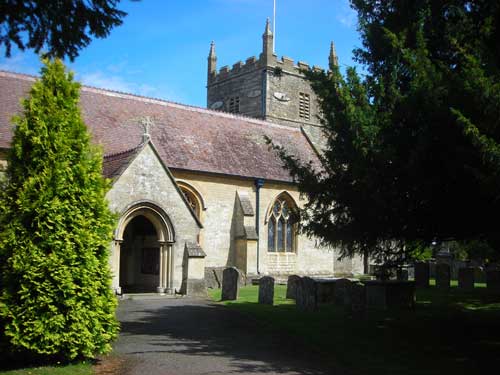
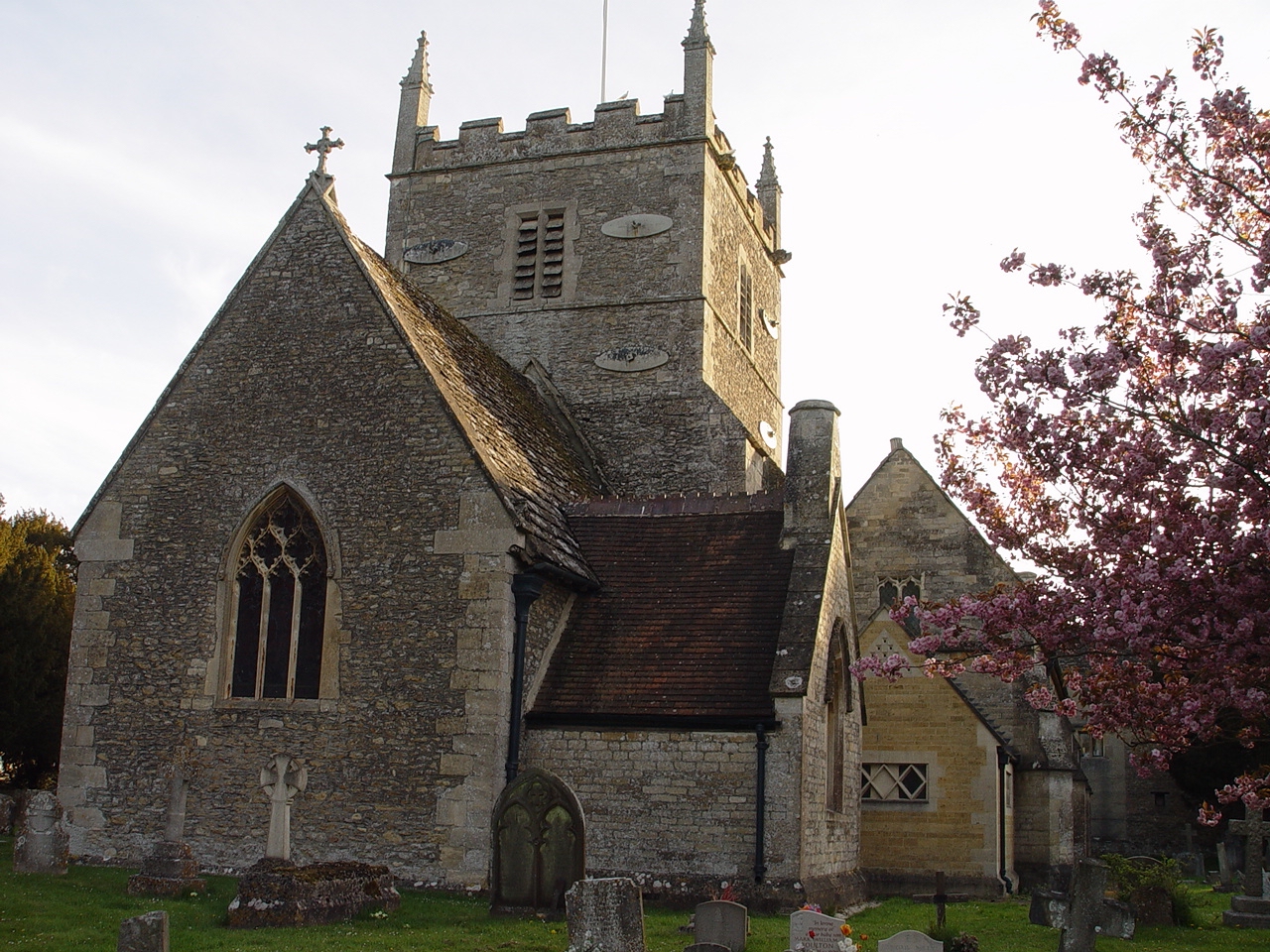
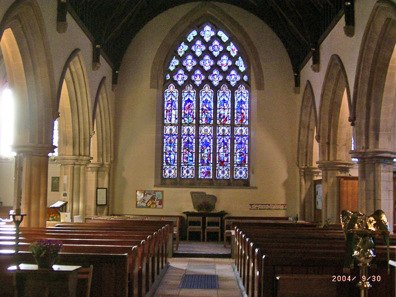
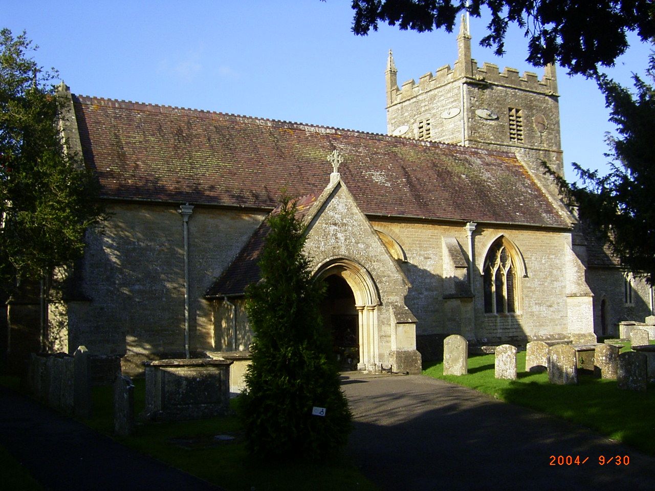
| Description | : | All Hallows is a large church, which dates from the Norman period. The building consists of the chancel, nave, aisles, south porch and an embattled central tower, topped once with a spire, but later removed during restoration in the 19th century. The church dates from the 12th century has find examples of Norman carvings including a depiction of "The Christ in Glory and The Harrowing Of Hell" above the south door. The south aisle and open pews were added in 1862 during the thorough restoration project carried out by architect, J.P St Aubyn, also responsible for restoring the Chapel at... Read More |
frequently asked questions (FAQ):
-
Where is All Hallows Churchyard?
All Hallows Churchyard is located at Church Lane South Cerney, Cotswold District ,Gloucestershire , GL7 5TTEngland.
-
All Hallows Churchyard cemetery's updated grave count on graveviews.com?
43 memorials
-
Where are the coordinates of the All Hallows Churchyard?
Latitude: 51.6748248
Longitude: -1.9292083
Nearby Cemetories:
1. Holy Cross Churchyard
Ashton Keynes, Wiltshire Unitary Authority, England
Coordinate: 51.6479000, -1.9394000
2. All Saints Churchyard
Down Ampney, Cotswold District, England
Coordinate: 51.6674850, -1.8592640
3. Ampney St. Mary Parish Churchyard
Ampney St Mary, Cotswold District, England
Coordinate: 51.7125000, -1.8919000
4. Ampney St Peter Churchyard
Ampney St Peter, Cotswold District, England
Coordinate: 51.7126320, -1.8918160
5. Poulton Priory
Poulton, Cotswold District, England
Coordinate: 51.6989750, -1.8638940
6. Chesterton Cemetery
Cirencester, Cotswold District, England
Coordinate: 51.7099230, -1.9801340
7. St. John the Baptist Churchyard
Cirencester, Cotswold District, England
Coordinate: 51.7175600, -1.9678580
8. All Saints Church
Kemble, Cotswold District, England
Coordinate: 51.6711000, -2.0154000
9. Cricklade Cemetery
Cricklade, Wiltshire Unitary Authority, England
Coordinate: 51.6414360, -1.8605570
10. St. Mary's Churchyard
Cricklade, Wiltshire Unitary Authority, England
Coordinate: 51.6435624, -1.8553451
11. St. Sampson Churchyard
Cricklade, Wiltshire Unitary Authority, England
Coordinate: 51.6405970, -1.8580760
12. St Mary Magdalene Churchyard
Baunton, Cotswold District, England
Coordinate: 51.7400511, -1.9692225
13. Stratton Cemetery
Cirencester, Cotswold District, England
Coordinate: 51.7353020, -1.9859041
14. St Mary Churchyard
Barnsley, Cotswold District, England
Coordinate: 51.7445030, -1.8894860
15. St Matthew Churchyard
Coates, Cotswold District, England
Coordinate: 51.7077470, -2.0411010
16. Parish Church of St. Mary
Castle Eaton, Swindon Unitary Authority, England
Coordinate: 51.6624180, -1.7896647
17. All Saints Churchyard
Crudwell, Wiltshire Unitary Authority, England
Coordinate: 51.6349050, -2.0644280
18. St Peter Churchyard
Rodmarton, Cotswold District, England
Coordinate: 51.6812230, -2.0841920
19. St. Thomas Churchyard
Fairford, Cotswold District, England
Coordinate: 51.7028776, -1.7801562
20. St. Mary the Virgin Churchyard
Fairford, Cotswold District, England
Coordinate: 51.7088500, -1.7814600
21. All Saints Churchyard
North Cerney, Cotswold District, England
Coordinate: 51.7687300, -1.9746800
22. St. Mary's Churchyard
Kempsford, Cotswold District, England
Coordinate: 51.6670420, -1.7681363
23. St. Mary the Virgin Churchyard
Bibury, Cotswold District, England
Coordinate: 51.7587037, -1.8376852
24. St Andrew's Church
Blunsdon St Andrew, Swindon Unitary Authority, England
Coordinate: 51.6059595, -1.8048494