
| Memorials | : | 1 |
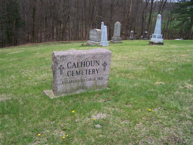
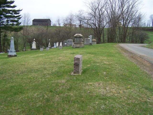
| Location | : | Armstrong County, USA |
| Coordinate | : | 40.8502426, -79.3848648 |
| Description | : | In Rayburn Township, near Kittanning, Armstrong County, PA, at the intersection of State Route 85 with State Route 28/66, take route 28/66 North for 5.86 miles to the intersection at Oscar Road. When you see the Mateer Cemetery, on your left, Oscar Road is the 2nd right turn about 300 yards from this church and cemetery. Turn right on Oscar Road and drive 2.1 miles to the intersection at Elkin Road. At this intersection, turn right onto Elkin Road (T870) and drive for 0.2 miles to the intersection of Calhoun Road. At this intersection, turn right onto Calhoun... Read More |
frequently asked questions (FAQ):
-
Where is Calhoun Cemetery?
Calhoun Cemetery is located at Armstrong County ,Pennsylvania ,USA.
-
Calhoun Cemetery cemetery's updated grave count on graveviews.com?
1 memorials
-
Where are the coordinates of the Calhoun Cemetery?
Latitude: 40.8502426
Longitude: -79.3848648

Nearby Cemetories:
1. Scott Fox Memorial Site
Kittanning, Armstrong County, USA
Coordinate: 40.8457580, -79.3972170
2. Mount Zion Presbyterian Cemetery
Boggs Township, Armstrong County, USA
Coordinate: 40.8717100, -79.4171980
3. Mateer Cemetery
Armstrong County, USA
Coordinate: 40.8721000, -79.4175000
4. Salem United Church of Christ Cemetery
Kittanning, Armstrong County, USA
Coordinate: 40.8244130, -79.3559970
5. Mount Union Davis Cemetery
Armstrong County, USA
Coordinate: 40.8323850, -79.4236530
6. Pine Creek Methodist Cemetery
Pine Furnace, Armstrong County, USA
Coordinate: 40.8497870, -79.4309590
7. Pleasant Union Cemetery
Cowanshannock Township, Armstrong County, USA
Coordinate: 40.8314018, -79.3350449
8. Rehobeth Reformed Presbyterian Church Cemetery
Kittanning, Armstrong County, USA
Coordinate: 40.8922670, -79.3695690
9. Echo Methodist Episcopal Church Cemetery
Armstrong County, USA
Coordinate: 40.8570420, -79.3275330
10. Lower Piney Cemetery
Armstrong County, USA
Coordinate: 40.8655920, -79.4395400
11. Elgin-Old Presbyterian Cemetery
Rural Valley, Armstrong County, USA
Coordinate: 40.8046646, -79.3662949
12. Schrecengost Farm Cemetery
Armstrong County, USA
Coordinate: 40.8288070, -79.3177450
13. Pine Creek Baptist Church Cemetery
Kittanning, Armstrong County, USA
Coordinate: 40.8514748, -79.4601440
14. Concord Presbyterian Church Cemetery
Wayne Township, Armstrong County, USA
Coordinate: 40.8910599, -79.3240356
15. Saint Michael's Episcopal Cemetery
Rural Valley, Armstrong County, USA
Coordinate: 40.8542328, -79.3036499
16. Simpson Church Cemetery
Kittanning, Armstrong County, USA
Coordinate: 40.7899000, -79.4083640
17. Good Shepherd Cemetery
Fenelton, Butler County, USA
Coordinate: 40.8434590, -79.4741510
18. Ritchison Farm Cemetery
Armstrong County, USA
Coordinate: 40.8475000, -79.4747000
19. Cochran Cemetery
Templeton, Armstrong County, USA
Coordinate: 40.8941994, -79.4582977
20. Jerusalem Lutheran Cemetery
Wayne Township, Armstrong County, USA
Coordinate: 40.9197006, -79.3566971
21. Rural Valley Cemetery
Rural Valley, Armstrong County, USA
Coordinate: 40.8019714, -79.3118515
22. Sowers Cemetery
Rural Valley, Armstrong County, USA
Coordinate: 40.7775993, -79.3703003
23. Belknap Cemetery
Dayton, Armstrong County, USA
Coordinate: 40.8926000, -79.2957000
24. Rupp Lutheran Church Cemetery
Kittanning, Armstrong County, USA
Coordinate: 40.7866516, -79.4561920