
| Memorials | : | 1 |
| Location | : | Ingestre, Stafford Borough, England |
| Coordinate | : | 52.8196420, -2.0361510 |
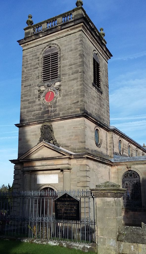
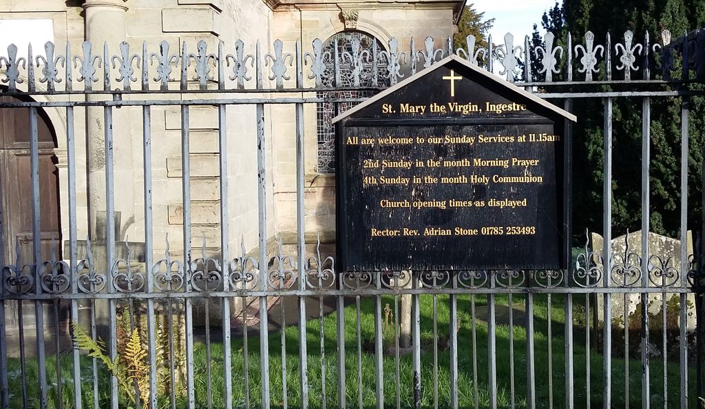
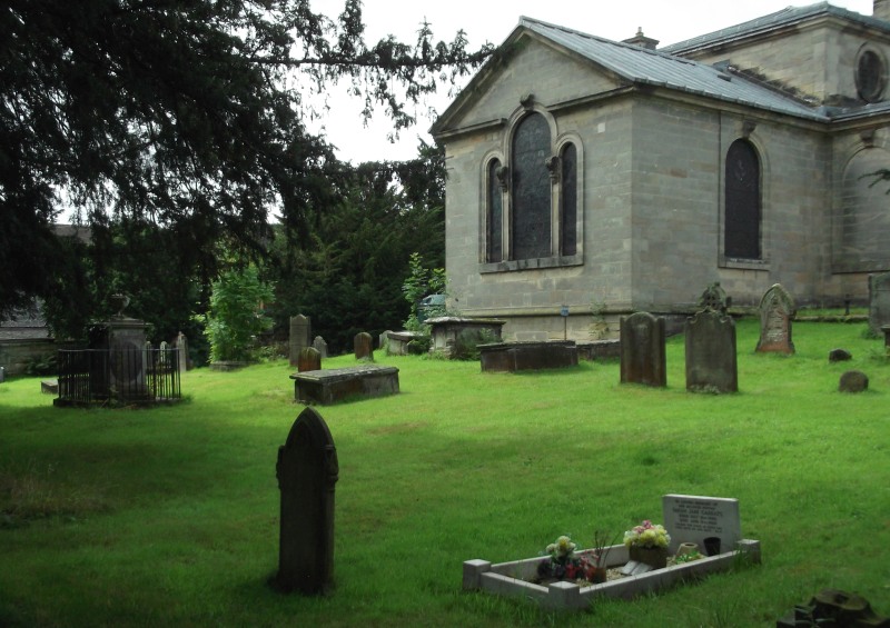
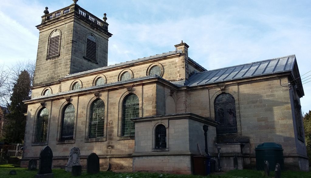
| Description | : | Ingestre church Ingestre church of St Mary the VirginIngestre parish church of St Mary the Virgin, is positioned very close by "near the SE corner of the Hall, a small handsome fabric in the Grecian style, built in 1676, by Walter Chetwynd, Esq, at a short distance from the old one, which was taken down, after the bones and memorials of the dead had been removed from it to the new edifice." [From William White, History, Gazetteer and Directory of Staffordshire, Sheffield, 1851 The church is widely reputed to have been designed by Sir Christopher Wren, and is "the only church... Read More |
frequently asked questions (FAQ):
-
Where is St Mary The Virgin Churchyard?
St Mary The Virgin Churchyard is located at Ingestre, Stafford Borough ,Staffordshire , ST18 0REEngland.
-
St Mary The Virgin Churchyard cemetery's updated grave count on graveviews.com?
1 memorials
-
Where are the coordinates of the St Mary The Virgin Churchyard?
Latitude: 52.8196420
Longitude: -2.0361510
Nearby Cemetories:
1. St. Andrew's Church
Weston, Stafford Borough, England
Coordinate: 52.8412239, -2.0391501
2. St. Peter's Churchyard
Hixon, Stafford Borough, England
Coordinate: 52.8273830, -2.0004581
3. Stafford Crematorium and Burial Ground
Stafford, Stafford Borough, England
Coordinate: 52.8080900, -2.0747420
4. St Stephen Churchyard
Great Haywood, Stafford Borough, England
Coordinate: 52.8004360, -2.0049890
5. St Peter's Church
Gayton, Stafford Borough, England
Coordinate: 52.8540363, -2.0327095
6. St James the Great Church
Salt, Stafford Borough, England
Coordinate: 52.8483296, -2.0701182
7. Saint Mary's Abbey
Colwich, Stafford Borough, England
Coordinate: 52.7900000, -1.9895000
8. St. Michael and All Angels Church
Colwich, Stafford Borough, England
Coordinate: 52.7876070, -1.9853500
9. All Saints Churchyard
Sandon, Stafford Borough, England
Coordinate: 52.8628160, -2.0696270
10. Stafford Prison Cemetery
Stafford, Stafford Borough, England
Coordinate: 52.8122341, -2.1166098
11. St Chad
Stafford, Stafford Borough, England
Coordinate: 52.8061611, -2.1165797
12. St. Mary's Churchyard
Stafford, Stafford Borough, England
Coordinate: 52.8057000, -2.1187000
13. Eccleshall Road Cemetery
Stafford, Stafford Borough, England
Coordinate: 52.8158760, -2.1252976
14. All Saints Churchyard
Milwich, Stafford Borough, England
Coordinate: 52.8852590, -2.0443610
15. St. James Churchyard
Acton Trussell, South Staffordshire Borough, England
Coordinate: 52.7546980, -2.0943120
16. Rugeley Cemetery
Rugeley, Cannock Chase District, England
Coordinate: 52.7650720, -1.9370440
17. The Old Chancel
Rugeley, Cannock Chase District, England
Coordinate: 52.7648400, -1.9355010
18. St. Augustine's Churchyard
Rugeley, Cannock Chase District, England
Coordinate: 52.7644253, -1.9345868
19. Cannock Chase War Cemetery
Cannock, Cannock Chase District, England
Coordinate: 52.7370710, -2.0266340
20. Cannock Chase German Military Cemetery
Cannock, Cannock Chase District, England
Coordinate: 52.7370580, -2.0265050
21. St Saviour Churchyard
Aston-by-Stone, Stafford Borough, England
Coordinate: 52.8841410, -2.1283140
22. St. John the Baptist Churchyard
Kingstone, East Staffordshire Borough, England
Coordinate: 52.8630944, -1.9115108
23. Stone Cemetery
Stone, Stafford Borough, England
Coordinate: 52.8874860, -2.1369430
24. St. Nicholas Churchyard
Abbots Bromley, East Staffordshire Borough, England
Coordinate: 52.8184560, -1.8837460