
| Birth | : | 1 Jan 1858 Gilmer County, West Virginia, USA |
| Death | : | 27 Apr 1932 Grantsville, Calhoun County, West Virginia, USA |
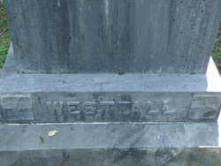
| Burial | : | Independence Cemetery, Independence, Kenton County, USA |
| Coordinate | : | 38.9364014, -84.5419006 |
| Description | : | Daughter of Lemiel "Major" Stump and Malinda (Huffman) Stump. Married Jan. 8,1880 to Julius Worth Pell. |
frequently asked questions (FAQ):
-
Where is Florence Stump Pell's memorial?
Florence Stump Pell's memorial is located at: Independence Cemetery, Independence, Kenton County, USA.
-
When did Florence Stump Pell death?
Florence Stump Pell death on 27 Apr 1932 in Grantsville, Calhoun County, West Virginia, USA
-
Where are the coordinates of the Florence Stump Pell's memorial?
Latitude: 38.9364014
Longitude: -84.5419006
Family Members:
Parent

Spouse
Siblings
Children
Flowers:


Nearby Cemetories:
1. Independence Cemetery
Independence, Kenton County, USA
Coordinate: 38.9364014, -84.5419006
2. Saint Cecilias Cemetery
Independence, Kenton County, USA
Coordinate: 38.9397011, -84.5466995
3. McCollum Cemetery
Independence, Kenton County, USA
Coordinate: 38.9431490, -84.5350520
4. B'Hymer Cemetery
Independence, Kenton County, USA
Coordinate: 38.9525000, -84.5575000
5. Faulkner Cemetery
Independence, Kenton County, USA
Coordinate: 38.9166670, -84.5333330
6. Pelly Cemetery
Latonia Lakes, Kenton County, USA
Coordinate: 38.9611110, -84.5294440
7. Grizzell Family Cemetery
Independence, Kenton County, USA
Coordinate: 38.9260320, -84.5089030
8. Hoffman Cemetery
Independence, Kenton County, USA
Coordinate: 38.9616670, -84.5630560
9. Hoffman Cemetery
Independence, Kenton County, USA
Coordinate: 38.9102777, -84.5200000
10. Wilson-Williams Cemetery
Ricedale, Kenton County, USA
Coordinate: 38.9409840, -84.5832880
11. Stephens Cemetery
Ryland Heights, Kenton County, USA
Coordinate: 38.9374570, -84.4977570
12. Bird Cemetery
Independence, Kenton County, USA
Coordinate: 38.9027780, -84.5327780
13. Cox Cemetery
Covington, Kenton County, USA
Coordinate: 38.9716670, -84.5188890
14. Minter Cemetery
Covington, Kenton County, USA
Coordinate: 38.9642300, -84.5055100
15. Armstrong Cemetery #1
Nicholson, Kenton County, USA
Coordinate: 38.8961111, -84.5338889
16. Dewire Cemetery
Ricedale, Kenton County, USA
Coordinate: 38.9361110, -84.5963890
17. Osborn Cemetery
Latonia Lakes, Kenton County, USA
Coordinate: 38.9661110, -84.5016670
18. Ashford Road Cemetery
Independence, Kenton County, USA
Coordinate: 38.9528850, -84.4892100
19. Petty Cemetery
Ryland, Kenton County, USA
Coordinate: 38.9391000, -84.4847100
20. Lighthouse Memorial Gardens
Covington, Kenton County, USA
Coordinate: 38.9689350, -84.5025500
21. Klette Cemetery
Latonia Lakes, Kenton County, USA
Coordinate: 38.9616670, -84.4944400
22. Oak Ridge Church Cemetery
Latonia Lakes, Kenton County, USA
Coordinate: 38.9691460, -84.5024180
23. Aaron Wayman Cemetery
Independence, Kenton County, USA
Coordinate: 38.9819440, -84.5469440
24. Rector Cemetery
Independence, Kenton County, USA
Coordinate: 38.9433300, -84.6002800