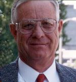
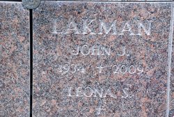
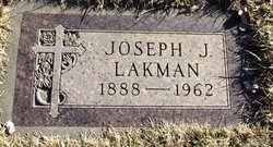
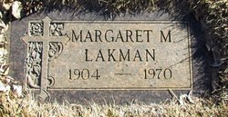
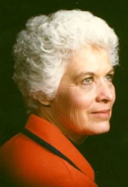
John James Lakman
| Birth | : | 14 Mar 1934 Sweet Grass, Toole County, Montana, USA |
| Death | : | 30 Sep 2009 Bountiful, Davis County, Utah, USA |
| Burial | : | Northfield Farms Cemetery, Northfield, Franklin County, USA |
| Coordinate | : | 42.6124992, -72.4741974 |
| Plot | : | Mausoleum |
| Description | : | John James Lakman passed away on September 30, 2009 at his home in Bountiful. He was born March 14, 1934 in Sweetgrass, Montana to Joseph and Margaret Pogreba Lakman. He was raised and educated in Montana. He served in the U.S. Navy. He married Leona Schweitzer on April 11, 1959 in Hingham, Montana. In 1963, the couple moved to Bountiful, where they made their home and raised their family. He was retired from IBM, where he worked for 32 years as a Computer Technician. He was a skilled and resourceful man who enjoyed working with his hands and helping others with... Read More |
frequently asked questions (FAQ):
-
Where is John James Lakman's memorial?
John James Lakman's memorial is located at: Northfield Farms Cemetery, Northfield, Franklin County, USA.
-
When did John James Lakman death?
John James Lakman death on 30 Sep 2009 in Bountiful, Davis County, Utah, USA
-
Where are the coordinates of the John James Lakman's memorial?
Latitude: 42.6124992
Longitude: -72.4741974
Family Members:
Parent
Spouse
Siblings
Flowers:
Nearby Cemetories:
1. Northfield Farms Cemetery
Northfield, Franklin County, USA
Coordinate: 42.6124992, -72.4741974
2. Durkee Burial Lot
Northfield, Franklin County, USA
Coordinate: 42.6070000, -72.4861000
3. Holton Cemetery
Erving, Franklin County, USA
Coordinate: 42.5799500, -72.4634600
4. Gill Center Cemetery
Gill, Franklin County, USA
Coordinate: 42.6413803, -72.4983063
5. Diemand Family Cemetery
Wendell, Franklin County, USA
Coordinate: 42.5769900, -72.4520600
6. North Cemetery
Gill, Franklin County, USA
Coordinate: 42.6514160, -72.4817630
7. Beers Ambush Gravesite
Northfield, Franklin County, USA
Coordinate: 42.6501200, -72.4560300
8. East Mineral Road Cemetery
Montague, Franklin County, USA
Coordinate: 42.5810500, -72.5086300
9. Highland Cemetery
Montague, Franklin County, USA
Coordinate: 42.5778008, -72.5083008
10. South Mountain Road Cemetery
Northfield, Franklin County, USA
Coordinate: 42.6375008, -72.4167023
11. Riverside Cemetery
Gill, Franklin County, USA
Coordinate: 42.6156006, -72.5410995
12. West Gill Cemetery
Gill, Franklin County, USA
Coordinate: 42.6442700, -72.5280500
13. Erving Center Cemetery
Erving, Franklin County, USA
Coordinate: 42.6033300, -72.4056800
14. Dry Hill Cemetery
Montague, Franklin County, USA
Coordinate: 42.5558300, -72.4647600
15. Town Cemetery
Montague, Franklin County, USA
Coordinate: 42.5595000, -72.5070200
16. Our Lady of Czestochowa Cemetery
Montague, Franklin County, USA
Coordinate: 42.5846000, -72.5469400
17. Saint Annes Cemetery
Montague, Franklin County, USA
Coordinate: 42.5861300, -72.5480600
18. Saint Marys Cemetery
Montague, Franklin County, USA
Coordinate: 42.5852200, -72.5475100
19. Aaron Clark Memorial Cemetery
Montague, Franklin County, USA
Coordinate: 42.5836200, -72.5471600
20. Springdale Cemetery
Montague, Franklin County, USA
Coordinate: 42.5884700, -72.5530900
21. Mount Hermon Cemetery
Northfield, Franklin County, USA
Coordinate: 42.6790800, -72.4821100
22. Fairway Avenue Cemetery
Montague, Franklin County, USA
Coordinate: 42.5924270, -72.5646970
23. Greenfield Hebrew Congregation Cemetery
Greenfield, Franklin County, USA
Coordinate: 42.6409410, -72.5653360
24. Coller Cemetery
Northfield, Franklin County, USA
Coordinate: 42.6563988, -72.3930969

