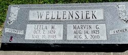
Marvin G. Wellensiek
| Birth | : | 14 Aug 1925 Lincoln, Lancaster County, Nebraska, USA |
| Death | : | 3 Aug 2010 Syracuse, Otoe County, Nebraska, USA |
| Burial | : | Holy Trinity Churchyard, Over Worton, West Oxfordshire District, England |
| Coordinate | : | 51.9598240, -1.3753620 |
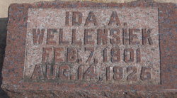
| Description | : | Marvin Wellensiek was born, August 14, 1925, in Lincoln, Nebraska, to Ida Wellensiek. He passed away, on August 3, 2010, at the Community Memorial Hospital, in Syracuse, Nebraska, at the age of 84 years, 11 month, and 20 days. Marvin married Leela Mandery, on August 17, 1952 at St. Paul's U.C.C. in Cook, Nebraska, and to this union they had a daughter, Debra. In May of 1995 Leela passed away. October 7, 1995 Marvin married Jean Hackler in Grove, Oklahoma. He loved farming and working his cattle. Loved to wear his John Deere hat; catching up on the local information... Read More |
frequently asked questions (FAQ):
-
Where is Marvin G. Wellensiek's memorial?
Marvin G. Wellensiek's memorial is located at: Holy Trinity Churchyard, Over Worton, West Oxfordshire District, England.
-
When did Marvin G. Wellensiek death?
Marvin G. Wellensiek death on 3 Aug 2010 in Syracuse, Otoe County, Nebraska, USA
-
Where are the coordinates of the Marvin G. Wellensiek's memorial?
Latitude: 51.9598240
Longitude: -1.3753620
Family Members:
Parent
Spouse
Siblings
Flowers:
Nearby Cemetories:
1. Holy Trinity Churchyard
Over Worton, West Oxfordshire District, England
Coordinate: 51.9598240, -1.3753620
2. St James Churchyard
Nether Worton, West Oxfordshire District, England
Coordinate: 51.9678100, -1.3807900
3. St Martins Churchyard
Sandford St Martin, West Oxfordshire District, England
Coordinate: 51.9371500, -1.3901400
4. St Mary Magdelene Churchyard
Duns Tew, Cherwell District, England
Coordinate: 51.9528350, -1.3363090
5. St Michael and All Angels Churchyard
Great Tew, West Oxfordshire District, England
Coordinate: 51.9569280, -1.4205150
6. Barford St. Michael Churchyard
Barford St Michael, Cherwell District, England
Coordinate: 51.9903200, -1.3711500
7. St. Edward the Confessor Churchyard
Westcot Barton, West Oxfordshire District, England
Coordinate: 51.9280100, -1.3747200
8. Deddington Cemetery
Deddington, Cherwell District, England
Coordinate: 51.9824490, -1.3338930
9. St John's Churchyard
Barford St John, Cherwell District, England
Coordinate: 51.9955050, -1.3620350
10. Ss Peter and Paul Churchyard
Deddington, Cherwell District, England
Coordinate: 51.9817680, -1.3207470
11. St Johns Churchyard
Little Tew, West Oxfordshire District, England
Coordinate: 51.9540390, -1.4419230
12. Steeple Barton Churchyard
Steeple Barton, West Oxfordshire District, England
Coordinate: 51.9207670, -1.3498060
13. South Newington St Peter ad Vincula
South Newington, Cherwell District, England
Coordinate: 51.9970000, -1.4082300
14. St Marys Churchyard
North Aston, Cherwell District, England
Coordinate: 51.9562960, -1.3020350
15. SS Peter and Paul Churchyard
Steeple Aston, Cherwell District, England
Coordinate: 51.9311350, -1.3091000
16. Saint Giles
Wigginton, Cherwell District, England
Coordinate: 51.9966400, -1.4324000
17. Saint Laurence Churchyard
Milcombe, Cherwell District, England
Coordinate: 52.0083060, -1.4033990
18. St Mary Churchyard
Swerford, West Oxfordshire District, England
Coordinate: 51.9773470, -1.4593150
19. St John the Evangelist
Milton, Cherwell District, England
Coordinate: 52.0117900, -1.3452510
20. St Kenelm's Churchyard Extension
Enstone, West Oxfordshire District, England
Coordinate: 51.9240960, -1.4484250
21. St Mary's Churchyard
Bloxham, Cherwell District, England
Coordinate: 52.0181100, -1.3748900
22. St. Kenelms Churchyard
Enstone, West Oxfordshire District, England
Coordinate: 51.9232490, -1.4494010
23. St Nicholas Churchyard
Kiddington, West Oxfordshire District, England
Coordinate: 51.9032900, -1.4031790
24. St James Churchyard
Somerton, Cherwell District, England
Coordinate: 51.9539990, -1.2786200


