
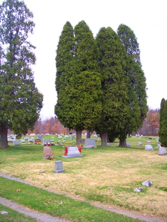
| Memorials | : | 2 |
| Location | : | Kittanning, Armstrong County, USA |
| Coordinate | : | 40.8514748, -79.4601440 |
| Description | : | From Kittanning, Pennsylvania, at the stoplight intersection of PA Route 28/66 and PA Route 85, drive north on PA Route 28/66, for 2.79 miles, to the Pine Creek Baptist Church, on the left. Turn left, just at and before the church and drive 0.25 miles, on Sloan Hill Road, to the cemetery, which is found, on the left. |
frequently asked questions (FAQ):
-
Where is Pine Creek Baptist Church Cemetery?
Pine Creek Baptist Church Cemetery is located at Kittanning, Armstrong County ,Pennsylvania , 16201USA.
-
Pine Creek Baptist Church Cemetery cemetery's updated grave count on graveviews.com?
2 memorials
-
Where are the coordinates of the Pine Creek Baptist Church Cemetery?
Latitude: 40.8514748
Longitude: -79.4601440
Nearby Cemetories:
1. Ritchison Farm Cemetery
Armstrong County, USA
Coordinate: 40.8475000, -79.4747000
2. Good Shepherd Cemetery
Fenelton, Butler County, USA
Coordinate: 40.8434590, -79.4741510
3. Lower Piney Cemetery
Armstrong County, USA
Coordinate: 40.8655920, -79.4395400
4. Pine Creek Methodist Cemetery
Pine Furnace, Armstrong County, USA
Coordinate: 40.8497870, -79.4309590
5. Myers-Patton Cemetery
Adrian, Armstrong County, USA
Coordinate: 40.8619270, -79.4972458
6. Mount Union Davis Cemetery
Armstrong County, USA
Coordinate: 40.8323850, -79.4236530
7. Mount Zion Presbyterian Cemetery
Boggs Township, Armstrong County, USA
Coordinate: 40.8717100, -79.4171980
8. Mateer Cemetery
Armstrong County, USA
Coordinate: 40.8721000, -79.4175000
9. Cochran Cemetery
Templeton, Armstrong County, USA
Coordinate: 40.8941994, -79.4582977
10. Saint Joseph Cemetery
Kittanning, Armstrong County, USA
Coordinate: 40.8266983, -79.5074997
11. County Home Cemetery
Armstrong County, USA
Coordinate: 40.8114710, -79.4842390
12. Croyle Cemetery
Adrian, Armstrong County, USA
Coordinate: 40.8782997, -79.5108032
13. Scott Fox Memorial Site
Kittanning, Armstrong County, USA
Coordinate: 40.8457580, -79.3972170
14. Saint Marys Cemetery
Kittanning, Armstrong County, USA
Coordinate: 40.8347015, -79.5239029
15. Kittanning Cemetery
Kittanning, Armstrong County, USA
Coordinate: 40.8231140, -79.5174340
16. John Cemetery
Frenchs Corners, Armstrong County, USA
Coordinate: 40.9003296, -79.4978409
17. Calhoun Cemetery
Armstrong County, USA
Coordinate: 40.8502426, -79.3848648
18. Toy Family Cemetery
Adrian, Armstrong County, USA
Coordinate: 40.8971130, -79.5082120
19. Old Kittanning Cemetery (Defunct)
Kittanning, Armstrong County, USA
Coordinate: 40.8183950, -79.5243840
20. Limestone Church of God Cemetery
Adrian, Armstrong County, USA
Coordinate: 40.8968887, -79.5180740
21. Brush Valley Cemetery
Adrian, Armstrong County, USA
Coordinate: 40.9044000, -79.5062000
22. Rupp Lutheran Church Cemetery
Kittanning, Armstrong County, USA
Coordinate: 40.7866516, -79.4561920
23. Montgomeryville Baptist Church Cemetery
Adrian, Armstrong County, USA
Coordinate: 40.8866615, -79.5376434
24. Crissman Family Cemetery
Adrian, Armstrong County, USA
Coordinate: 40.8877490, -79.5402750