
| Memorials | : | 0 |
| Location | : | Adrian, Armstrong County, USA |
| Coordinate | : | 40.8971130, -79.5082120 |
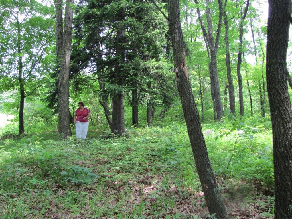
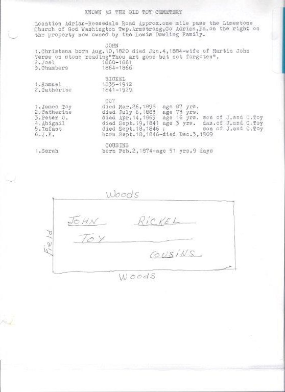
| Description | : | THIS CEMETERY IS ALSO KNOWN AS "THE OLD TOY CEMETERY." This is an old and abandoned family cemetery whose last known burial was in 1926. It is on the old Doweling property and is in a sad state of disrepair. It is overgrown with brush and there are trees that are overtaking a couple of the remaining markers. There are at least 10 unmarked graves and there are also about a half dozen graves marked only with fieldstones, which have no inscription. The current property owners are not happy with the upkeep state of this place, but... Read More |
frequently asked questions (FAQ):
-
Where is Toy Family Cemetery?
Toy Family Cemetery is located at Adrian, Armstrong County ,Pennsylvania ,USA.
-
Toy Family Cemetery cemetery's updated grave count on graveviews.com?
0 memorials
-
Where are the coordinates of the Toy Family Cemetery?
Latitude: 40.8971130
Longitude: -79.5082120
Nearby Cemetories:
1. Brush Valley Cemetery
Adrian, Armstrong County, USA
Coordinate: 40.9044000, -79.5062000
2. Limestone Church of God Cemetery
Adrian, Armstrong County, USA
Coordinate: 40.8968887, -79.5180740
3. John Cemetery
Frenchs Corners, Armstrong County, USA
Coordinate: 40.9003296, -79.4978409
4. Croyle Cemetery
Adrian, Armstrong County, USA
Coordinate: 40.8782997, -79.5108032
5. Saint Mark's Lutheran Church Cemetery
Adrian, Armstrong County, USA
Coordinate: 40.8960152, -79.5370865
6. Montgomeryville Baptist Church Cemetery
Adrian, Armstrong County, USA
Coordinate: 40.8866615, -79.5376434
7. Crissman Family Cemetery
Adrian, Armstrong County, USA
Coordinate: 40.8877490, -79.5402750
8. Bowser Cemetery
Morrows Corner, Armstrong County, USA
Coordinate: 40.9185070, -79.5341170
9. Myers-Patton Cemetery
Adrian, Armstrong County, USA
Coordinate: 40.8619270, -79.4972458
10. Cochran Cemetery
Templeton, Armstrong County, USA
Coordinate: 40.8941994, -79.4582977
11. Old Earley Family Graveyard
Rimer, Armstrong County, USA
Coordinate: 40.9361115, -79.5255585
12. Rimer Hill Cemetery
Armstrong County, USA
Coordinate: 40.9398130, -79.4990980
13. Toy Cemetery
Reesedale, Armstrong County, USA
Coordinate: 40.9297750, -79.4706770
14. Bell Town Road Cemetery
Templeton, Armstrong County, USA
Coordinate: 40.9243110, -79.4624050
15. Fair Cemetery
Cowansville, Armstrong County, USA
Coordinate: 40.8961334, -79.5667419
16. Walthour Cemetery
Reesedale, Armstrong County, USA
Coordinate: 40.9379000, -79.4756000
17. Sherrett Cemetery
Sherrett, Armstrong County, USA
Coordinate: 40.9329185, -79.5553360
18. Ritchison Farm Cemetery
Armstrong County, USA
Coordinate: 40.8475000, -79.4747000
19. Pine Creek Baptist Church Cemetery
Kittanning, Armstrong County, USA
Coordinate: 40.8514748, -79.4601440
20. Herron Family Cemetery
Cowansville, Armstrong County, USA
Coordinate: 40.8666170, -79.5751760
21. Good Shepherd Cemetery
Fenelton, Butler County, USA
Coordinate: 40.8434590, -79.4741510
22. Lower Piney Cemetery
Armstrong County, USA
Coordinate: 40.8655920, -79.4395400
23. Cowansville Cemetery
Cowansville, Armstrong County, USA
Coordinate: 40.8878860, -79.5878143
24. Rich Hill United Presbyterian Church Cemetery
Cowansville, Armstrong County, USA
Coordinate: 40.8916750, -79.5890490