
| Memorials | : | 0 |
| Location | : | Frenchs Corners, Armstrong County, USA |
| Coordinate | : | 40.9003296, -79.4978409 |
| Description | : | Driving directions: This cemetery is located alongside Adrian/Reesedale Rd. (SR 4006), in the geographical location of French's Corners, in Washington Township, Armstrong County, Pennsylvania, and it is in the 16201 zip code for Adrian, Pennsyvlania. In West Kittanning, Pennsyvlania, at the intersection of Business Route U.S. 422 (Butler Road) and PA State Route 268 (E. Brady Road) drive north and west on Route 268, towards Cowansville, for 4.77 miles to the "Y" intersection at Adrian/Reesedale Rd. (If you cross the rail road bridge and enter Cowansville you missed this turn). Bear right onto Adrian/Reesedale Road and drive for a total... Read More |
frequently asked questions (FAQ):
-
Where is John Cemetery?
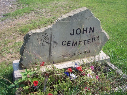
John Cemetery is located at Frenchs Corners, Armstrong County ,Pennsylvania , 16201USA.
-
John Cemetery cemetery's updated grave count on graveviews.com?
0 memorials
-
Where are the coordinates of the John Cemetery?
Latitude: 40.9003296
Longitude: -79.4978409
Nearby Cemetories:
1. Brush Valley Cemetery
Adrian, Armstrong County, USA
Coordinate: 40.9044000, -79.5062000
2. Toy Family Cemetery
Adrian, Armstrong County, USA
Coordinate: 40.8971130, -79.5082120
3. Limestone Church of God Cemetery
Adrian, Armstrong County, USA
Coordinate: 40.8968887, -79.5180740
4. Croyle Cemetery
Adrian, Armstrong County, USA
Coordinate: 40.8782997, -79.5108032
5. Saint Mark's Lutheran Church Cemetery
Adrian, Armstrong County, USA
Coordinate: 40.8960152, -79.5370865
6. Cochran Cemetery
Templeton, Armstrong County, USA
Coordinate: 40.8941994, -79.4582977
7. Bowser Cemetery
Morrows Corner, Armstrong County, USA
Coordinate: 40.9185070, -79.5341170
8. Montgomeryville Baptist Church Cemetery
Adrian, Armstrong County, USA
Coordinate: 40.8866615, -79.5376434
9. Crissman Family Cemetery
Adrian, Armstrong County, USA
Coordinate: 40.8877490, -79.5402750
10. Toy Cemetery
Reesedale, Armstrong County, USA
Coordinate: 40.9297750, -79.4706770
11. Bell Town Road Cemetery
Templeton, Armstrong County, USA
Coordinate: 40.9243110, -79.4624050
12. Myers-Patton Cemetery
Adrian, Armstrong County, USA
Coordinate: 40.8619270, -79.4972458
13. Rimer Hill Cemetery
Armstrong County, USA
Coordinate: 40.9398130, -79.4990980
14. Walthour Cemetery
Reesedale, Armstrong County, USA
Coordinate: 40.9379000, -79.4756000
15. Old Earley Family Graveyard
Rimer, Armstrong County, USA
Coordinate: 40.9361115, -79.5255585
16. Fair Cemetery
Cowansville, Armstrong County, USA
Coordinate: 40.8961334, -79.5667419
17. Stewardson Furnace Cemetery
Armstrong County, USA
Coordinate: 40.9331510, -79.4421280
18. Sherrett Cemetery
Sherrett, Armstrong County, USA
Coordinate: 40.9329185, -79.5553360
19. Ritchison Farm Cemetery
Armstrong County, USA
Coordinate: 40.8475000, -79.4747000
20. Lower Piney Cemetery
Armstrong County, USA
Coordinate: 40.8655920, -79.4395400
21. Pine Creek Baptist Church Cemetery
Kittanning, Armstrong County, USA
Coordinate: 40.8514748, -79.4601440
22. Tidal Cemetery
Tidal, Armstrong County, USA
Coordinate: 40.9582520, -79.4990020
23. Good Shepherd Cemetery
Fenelton, Butler County, USA
Coordinate: 40.8434590, -79.4741510
24. Mateer Cemetery
Armstrong County, USA
Coordinate: 40.8721000, -79.4175000