
| Memorials | : | 0 |
| Location | : | Adrian, Armstrong County, USA |
| Coordinate | : | 40.8968887, -79.5180740 |
| Description | : | Directions: From Kittanning, Armstrong County, Pa., at the "Y," which is the intersection of Business U.S. Route 422 and Pennsylvania Route 268, drive 4.77 miles north, on PA Route 268, to the "Y", which is the intersection of PA 268 and the Adrian/Reesedale Road. (If you cross the bridge over the railroad tracks, you just missed this road.) From the intersection of Adrian/Reesedale Road, with Pennsylvania 268, bear to the right on Adrian/Reesedale Road and drive 4.14 miles. You will pass thru the village of Adrian and under the railroad overpass. You are near, to the... Read More |
frequently asked questions (FAQ):
-
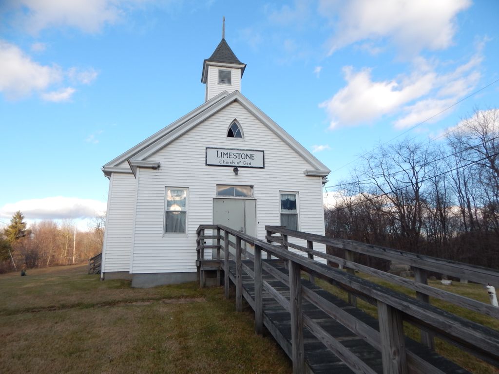
Where is Limestone Church of God Cemetery?
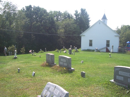
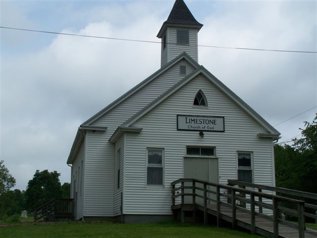
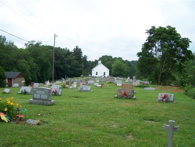
Limestone Church of God Cemetery is located at Adrian, Armstrong County ,Pennsylvania ,USA.
-
Limestone Church of God Cemetery cemetery's updated grave count on graveviews.com?
0 memorials
-
Where are the coordinates of the Limestone Church of God Cemetery?
Latitude: 40.8968887
Longitude: -79.5180740
Nearby Cemetories:
1. Toy Family Cemetery
Adrian, Armstrong County, USA
Coordinate: 40.8971130, -79.5082120
2. Brush Valley Cemetery
Adrian, Armstrong County, USA
Coordinate: 40.9044000, -79.5062000
3. Saint Mark's Lutheran Church Cemetery
Adrian, Armstrong County, USA
Coordinate: 40.8960152, -79.5370865
4. John Cemetery
Frenchs Corners, Armstrong County, USA
Coordinate: 40.9003296, -79.4978409
5. Montgomeryville Baptist Church Cemetery
Adrian, Armstrong County, USA
Coordinate: 40.8866615, -79.5376434
6. Crissman Family Cemetery
Adrian, Armstrong County, USA
Coordinate: 40.8877490, -79.5402750
7. Croyle Cemetery
Adrian, Armstrong County, USA
Coordinate: 40.8782997, -79.5108032
8. Bowser Cemetery
Morrows Corner, Armstrong County, USA
Coordinate: 40.9185070, -79.5341170
9. Fair Cemetery
Cowansville, Armstrong County, USA
Coordinate: 40.8961334, -79.5667419
10. Myers-Patton Cemetery
Adrian, Armstrong County, USA
Coordinate: 40.8619270, -79.4972458
11. Old Earley Family Graveyard
Rimer, Armstrong County, USA
Coordinate: 40.9361115, -79.5255585
12. Rimer Hill Cemetery
Armstrong County, USA
Coordinate: 40.9398130, -79.4990980
13. Cochran Cemetery
Templeton, Armstrong County, USA
Coordinate: 40.8941994, -79.4582977
14. Sherrett Cemetery
Sherrett, Armstrong County, USA
Coordinate: 40.9329185, -79.5553360
15. Toy Cemetery
Reesedale, Armstrong County, USA
Coordinate: 40.9297750, -79.4706770
16. Bell Town Road Cemetery
Templeton, Armstrong County, USA
Coordinate: 40.9243110, -79.4624050
17. Walthour Cemetery
Reesedale, Armstrong County, USA
Coordinate: 40.9379000, -79.4756000
18. Herron Family Cemetery
Cowansville, Armstrong County, USA
Coordinate: 40.8666170, -79.5751760
19. Cowansville Cemetery
Cowansville, Armstrong County, USA
Coordinate: 40.8878860, -79.5878143
20. Rich Hill United Presbyterian Church Cemetery
Cowansville, Armstrong County, USA
Coordinate: 40.8916750, -79.5890490
21. Simpson Cemetery
Cowansville, Armstrong County, USA
Coordinate: 40.9092150, -79.5941450
22. Ritchison Farm Cemetery
Armstrong County, USA
Coordinate: 40.8475000, -79.4747000
23. Saint Marys Cemetery
Kittanning, Armstrong County, USA
Coordinate: 40.8347015, -79.5239029
24. Campbell Family Cemetery
Walkchalk, Armstrong County, USA
Coordinate: 40.8420610, -79.5586110