
| Memorials | : | 0 |
| Location | : | Cowansville, Armstrong County, USA |
| Coordinate | : | 40.8916750, -79.5890490 |
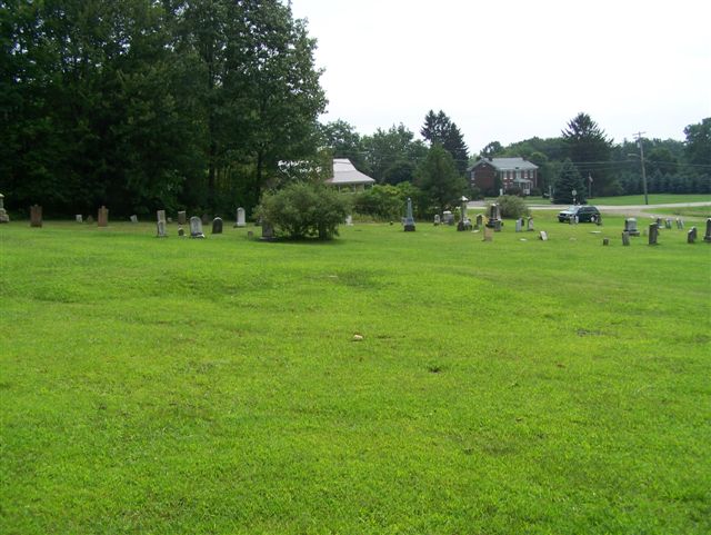
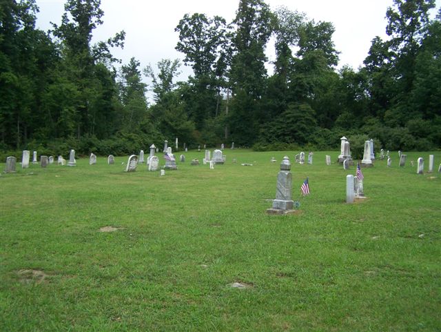
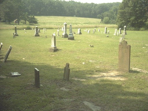
| Description | : | This is a small cemetery that many local people think used to be a Church Cemetery. However, most people, to whom I have spoken, can't remember what the name or denomination, of the Church, was. However, I feel it must have been the Presbyterian Church since that is what is recorded in the Book, "Armstrong County Pennsylvania, Her People, Past and Present...," Volume I, J.H. Beers & Co., Chicago, Ill., 1914, pp281-283. And now, today (27 Aug. 2009) I have spoken with the Rev. Mary Marks-King and Russell Snyder, both long time residents, of Cowansville and they... Read More |
frequently asked questions (FAQ):
-
Where is Rich Hill United Presbyterian Church Cemetery?
Rich Hill United Presbyterian Church Cemetery is located at Cowansville, Armstrong County ,Pennsylvania ,USA.
-
Rich Hill United Presbyterian Church Cemetery cemetery's updated grave count on graveviews.com?
0 memorials
-
Where are the coordinates of the Rich Hill United Presbyterian Church Cemetery?
Latitude: 40.8916750
Longitude: -79.5890490

Nearby Cemetories:
1. Cowansville Cemetery
Cowansville, Armstrong County, USA
Coordinate: 40.8878860, -79.5878143
2. Fair Cemetery
Cowansville, Armstrong County, USA
Coordinate: 40.8961334, -79.5667419
3. Simpson Cemetery
Cowansville, Armstrong County, USA
Coordinate: 40.9092150, -79.5941450
4. Herron Family Cemetery
Cowansville, Armstrong County, USA
Coordinate: 40.8666170, -79.5751760
5. Crissman Family Cemetery
Adrian, Armstrong County, USA
Coordinate: 40.8877490, -79.5402750
6. Montgomeryville Baptist Church Cemetery
Adrian, Armstrong County, USA
Coordinate: 40.8866615, -79.5376434
7. Saint Mark's Lutheran Church Cemetery
Adrian, Armstrong County, USA
Coordinate: 40.8960152, -79.5370865
8. Sherrett Cemetery
Sherrett, Armstrong County, USA
Coordinate: 40.9329185, -79.5553360
9. Bowser Cemetery
Morrows Corner, Armstrong County, USA
Coordinate: 40.9185070, -79.5341170
10. Limestone Church of God Cemetery
Adrian, Armstrong County, USA
Coordinate: 40.8968887, -79.5180740
11. Campbell Family Cemetery
Walkchalk, Armstrong County, USA
Coordinate: 40.8420610, -79.5586110
12. Fox Cemetery
East Franklin Township, Armstrong County, USA
Coordinate: 40.8388050, -79.5630550
13. Croyle Cemetery
Adrian, Armstrong County, USA
Coordinate: 40.8782997, -79.5108032
14. Toy Family Cemetery
Adrian, Armstrong County, USA
Coordinate: 40.8971130, -79.5082120
15. Brush Valley Cemetery
Adrian, Armstrong County, USA
Coordinate: 40.9044000, -79.5062000
16. Old Earley Family Graveyard
Rimer, Armstrong County, USA
Coordinate: 40.9361115, -79.5255585
17. West Glade Run Presbyterian Cemetery
Armstrong County, USA
Coordinate: 40.8225000, -79.5857000
18. John Cemetery
Frenchs Corners, Armstrong County, USA
Coordinate: 40.9003296, -79.4978409
19. Saint Marys Cemetery
Kittanning, Armstrong County, USA
Coordinate: 40.8347015, -79.5239029
20. Myers-Patton Cemetery
Adrian, Armstrong County, USA
Coordinate: 40.8619270, -79.4972458
21. Rimer Hill Cemetery
Armstrong County, USA
Coordinate: 40.9398130, -79.4990980
22. Kittanning Cemetery
Kittanning, Armstrong County, USA
Coordinate: 40.8231140, -79.5174340
23. Oak Grove Cemetery
Frogtown, Armstrong County, USA
Coordinate: 40.9540710, -79.6701260
24. Old Kittanning Cemetery (Defunct)
Kittanning, Armstrong County, USA
Coordinate: 40.8183950, -79.5243840