
| Memorials | : | 5 |
| Location | : | Adrian, Armstrong County, USA |
| Phone | : | (724) 548-5004 |
| Coordinate | : | 40.8960152, -79.5370865 |
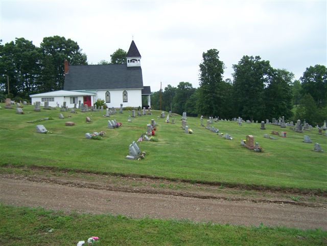
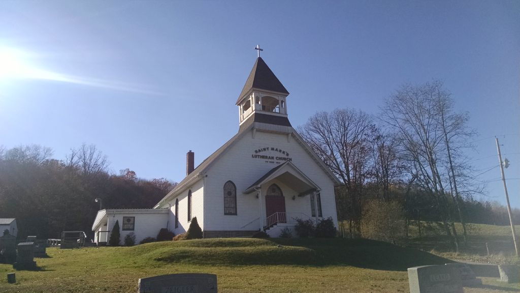
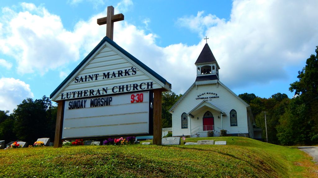
| Description | : | Directions: In West Kittanning, Pennsylvania, at the intersection of Business U.S. Route 422 and PA Route 268, take Route 268 North and West for 4.77 miles to Cowansville, Pennsylvania, and the intersection of PA Route 268 and Reesedale Road. At this intersection, bear right on the fork onto Reesdale Road and drive 3.25 miles thru the small village of Adrian and "under the railroad underpass," to the intersection of Reesedale and Sherrett Road. At this intersection, turn left onto Sherrett Road and drive 0.2 miles to the intersection of St. Marks Road. The St. Mark's Lutheran Church... Read More |
frequently asked questions (FAQ):
-
Where is Saint Mark's Lutheran Church Cemetery?
Saint Mark's Lutheran Church Cemetery is located at 280 St Marks Rd Adrian, Armstrong County ,Pennsylvania , 16210-9625USA.
-
Saint Mark's Lutheran Church Cemetery cemetery's updated grave count on graveviews.com?
5 memorials
-
Where are the coordinates of the Saint Mark's Lutheran Church Cemetery?
Latitude: 40.8960152
Longitude: -79.5370865
Nearby Cemetories:
1. Crissman Family Cemetery
Adrian, Armstrong County, USA
Coordinate: 40.8877490, -79.5402750
2. Montgomeryville Baptist Church Cemetery
Adrian, Armstrong County, USA
Coordinate: 40.8866615, -79.5376434
3. Limestone Church of God Cemetery
Adrian, Armstrong County, USA
Coordinate: 40.8968887, -79.5180740
4. Toy Family Cemetery
Adrian, Armstrong County, USA
Coordinate: 40.8971130, -79.5082120
5. Fair Cemetery
Cowansville, Armstrong County, USA
Coordinate: 40.8961334, -79.5667419
6. Bowser Cemetery
Morrows Corner, Armstrong County, USA
Coordinate: 40.9185070, -79.5341170
7. Brush Valley Cemetery
Adrian, Armstrong County, USA
Coordinate: 40.9044000, -79.5062000
8. Croyle Cemetery
Adrian, Armstrong County, USA
Coordinate: 40.8782997, -79.5108032
9. John Cemetery
Frenchs Corners, Armstrong County, USA
Coordinate: 40.9003296, -79.4978409
10. Cowansville Cemetery
Cowansville, Armstrong County, USA
Coordinate: 40.8878860, -79.5878143
11. Sherrett Cemetery
Sherrett, Armstrong County, USA
Coordinate: 40.9329185, -79.5553360
12. Rich Hill United Presbyterian Church Cemetery
Cowansville, Armstrong County, USA
Coordinate: 40.8916750, -79.5890490
13. Old Earley Family Graveyard
Rimer, Armstrong County, USA
Coordinate: 40.9361115, -79.5255585
14. Herron Family Cemetery
Cowansville, Armstrong County, USA
Coordinate: 40.8666170, -79.5751760
15. Simpson Cemetery
Cowansville, Armstrong County, USA
Coordinate: 40.9092150, -79.5941450
16. Myers-Patton Cemetery
Adrian, Armstrong County, USA
Coordinate: 40.8619270, -79.4972458
17. Rimer Hill Cemetery
Armstrong County, USA
Coordinate: 40.9398130, -79.4990980
18. Campbell Family Cemetery
Walkchalk, Armstrong County, USA
Coordinate: 40.8420610, -79.5586110
19. Cochran Cemetery
Templeton, Armstrong County, USA
Coordinate: 40.8941994, -79.4582977
20. Toy Cemetery
Reesedale, Armstrong County, USA
Coordinate: 40.9297750, -79.4706770
21. Fox Cemetery
East Franklin Township, Armstrong County, USA
Coordinate: 40.8388050, -79.5630550
22. Saint Marys Cemetery
Kittanning, Armstrong County, USA
Coordinate: 40.8347015, -79.5239029
23. Walthour Cemetery
Reesedale, Armstrong County, USA
Coordinate: 40.9379000, -79.4756000
24. Bell Town Road Cemetery
Templeton, Armstrong County, USA
Coordinate: 40.9243110, -79.4624050