
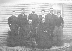
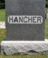

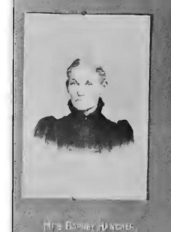
Barney O'Rourke Hanshaw Hancher
| Birth | : | 8 Feb 1831 Harrison County, Ohio, USA |
| Death | : | 13 Feb 1911 Plover, Pocahontas County, Iowa, USA |
| Burial | : | St Augustine Church, Brookland, Shepway District, England |
| Coordinate | : | 50.9973880, 0.8337460 |
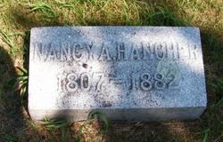
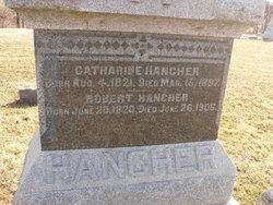
| Description | : | S/O John & Nancy Ann O'Rourke,Hancher[Hanshaw].H/O Margaret Ellenor Thomas,[1842-1918]F/O 5 Children. |
frequently asked questions (FAQ):
-
Where is Barney O'Rourke Hanshaw Hancher's memorial?
Barney O'Rourke Hanshaw Hancher's memorial is located at: St Augustine Church, Brookland, Shepway District, England.
-
When did Barney O'Rourke Hanshaw Hancher death?
Barney O'Rourke Hanshaw Hancher death on 13 Feb 1911 in Plover, Pocahontas County, Iowa, USA
-
Where are the coordinates of the Barney O'Rourke Hanshaw Hancher's memorial?
Latitude: 50.9973880
Longitude: 0.8337460
Family Members:
Parent
Spouse
Siblings

Children
Flowers:


Nearby Cemetories:
1. St Augustine Church
Brookland, Shepway District, England
Coordinate: 50.9973880, 0.8337460
2. Brenzett Cemetery
Brenzett, Shepway District, England
Coordinate: 51.0130800, 0.8561300
3. St Enswith's Church
Brenzett, Shepway District, England
Coordinate: 51.0138510, 0.8573170
4. St. Thomas à Becket Cemetery
Fairfield, Shepway District, England
Coordinate: 51.0043210, 0.7993930
5. St. Dunstan Churchyard
Snargate, Shepway District, England
Coordinate: 51.0227100, 0.8371750
6. St George's Church
Ivychurch, Shepway District, England
Coordinate: 51.0124590, 0.8895980
7. St Clement Churchyard
Old Romney, Shepway District, England
Coordinate: 50.9901390, 0.8981780
8. St Peter and St Paul Churchyard
Appledore, Ashford Borough, England
Coordinate: 51.0295660, 0.7903990
9. St Augustine Church
Snave, Ashford Borough, England
Coordinate: 51.0334570, 0.8710390
10. St Mary the Virgin Churchyard
Stone-cum-Ebony, Ashford Borough, England
Coordinate: 51.0127980, 0.7645592
11. St Mary's Churchyard
Kenardington, Ashford Borough, England
Coordinate: 51.0546000, 0.8164000
12. St. Matthew Churchyard
Warehorne, Ashford Borough, England
Coordinate: 51.0575460, 0.8375700
13. All Saints Churchyard
Lydd, Shepway District, England
Coordinate: 50.9518160, 0.9068730
14. Lydd Cemetery
Lydd, Shepway District, England
Coordinate: 50.9531810, 0.9127050
15. New Romney Cemetery
New Romney, Shepway District, England
Coordinate: 50.9843600, 0.9388800
16. Burma Campaign Memorial
New Romney, Shepway District, England
Coordinate: 50.9851600, 0.9404470
17. St Nicholas Churchyard
New Romney, Shepway District, England
Coordinate: 50.9850930, 0.9411740
18. All Saints Churchyard
Iden, Rother District, England
Coordinate: 50.9812930, 0.7275500
19. Iden Burial Ground
Iden, Rother District, England
Coordinate: 50.9813000, 0.7275300
20. St Mary the Virgin Churchyard
St Mary in the Marsh, Shepway District, England
Coordinate: 51.0141390, 0.9423380
21. Ebony Old Cemetery
Stone-cum-Ebony, Ashford Borough, England
Coordinate: 51.0378926, 0.7422129
22. St. Michael's Churchyard
Playden, Rother District, England
Coordinate: 50.9621200, 0.7327000
23. Rye Cemetery
Rye, Rother District, England
Coordinate: 50.9595370, 0.7322520
24. St. Mary the Virgin Churchyard
Reading Street, Ashford Borough, England
Coordinate: 51.0431442, 0.7400970