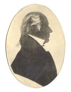
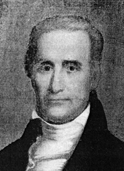
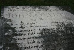
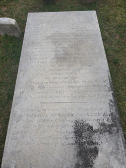
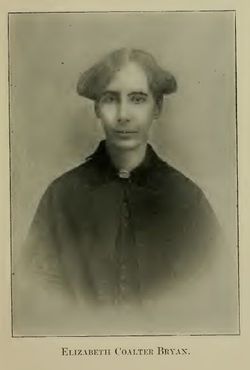
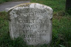
John Coalter
| Birth | : | 20 Aug 1769 Augusta County, Virginia, USA |
| Death | : | 2 Feb 1838 Chatham Heights, Stafford County, Virginia, USA |
| Burial | : | Gloucester Old Cemetery, Gloucester, City of Gloucester, England |
| Coordinate | : | 51.8482100, -2.2276700 |
| Description | : | He attended Liberty Hall Academy (now Washington and Lee University). He became tutor to the children of St. George Tucker and studied law. He returned to Augusta County where he practiced law. He was appointed sheriff in 1791 and clerk of the District Court in 1793, was appointed judge of the Circuit Superior Court of Law in 1809, and a judge of the Court of Appeals in 1811, serving until 1831. Coalter was a member of the Virginia Constitutional Convention of 1829-1830. He married first Maria Rind in 1790; second, Margaret Davenport in 1795; third, Anne Frances Bland... Read More |
frequently asked questions (FAQ):
-
Where is John Coalter's memorial?
John Coalter's memorial is located at: Gloucester Old Cemetery, Gloucester, City of Gloucester, England.
-
When did John Coalter death?
John Coalter death on 2 Feb 1838 in Chatham Heights, Stafford County, Virginia, USA
-
Where are the coordinates of the John Coalter's memorial?
Latitude: 51.8482100
Longitude: -2.2276700
Family Members:
Spouse
Children
Nearby Cemetories:
1. Gloucester Old Cemetery
Gloucester, City of Gloucester, England
Coordinate: 51.8482100, -2.2276700
2. Gloucester Crematorium
Gloucester, City of Gloucester, England
Coordinate: 51.8538180, -2.2219260
3. St Lawrence Churchyard
Barnwood, City of Gloucester, England
Coordinate: 51.8580470, -2.2069750
4. Horton Road Cemetery
Gloucester, City of Gloucester, England
Coordinate: 51.8666900, -2.2268300
5. St Margaret's Chapel
Gloucester, City of Gloucester, England
Coordinate: 51.8686720, -2.2321530
6. Saint Catharine's
Gloucester, City of Gloucester, England
Coordinate: 51.8691700, -2.2273500
7. Chapel of St Mary Magdalen
Gloucester, City of Gloucester, England
Coordinate: 51.8693000, -2.2291000
8. Llanthony Secunda Priory
Hempsted, City of Gloucester, England
Coordinate: 51.8602130, -2.2572640
9. Gloucester Cathedral
Gloucester, City of Gloucester, England
Coordinate: 51.8675920, -2.2467670
10. St Nicholas' Church
Gloucester, City of Gloucester, England
Coordinate: 51.8672800, -2.2496760
11. Saint Oswald's Priory
Gloucester, City of Gloucester, England
Coordinate: 51.8694000, -2.2478000
12. Ss Philip and James Churchyard
Hucclecote, Tewkesbury Borough, England
Coordinate: 51.8573040, -2.1876440
13. St. Swithun's Churchyard
Hempsted, City of Gloucester, England
Coordinate: 51.8515740, -2.2719420
14. St Margaret Church
Whaddon, Stroud District, England
Coordinate: 51.8214600, -2.2433000
15. St. James' Churchyard
Quedgeley, City of Gloucester, England
Coordinate: 51.8257770, -2.2811150
16. St. Swithun Churchyard
Brookthorpe, Stroud District, England
Coordinate: 51.8087500, -2.2402900
17. Prinknash Abbey
Cranham, Stroud District, England
Coordinate: 51.8225000, -2.1761110
18. St George Churchyard
Brockworth, Tewkesbury Borough, England
Coordinate: 51.8517460, -2.1598180
19. St. Matthew's Cemetery
Twigworth, Tewkesbury Borough, England
Coordinate: 51.8936090, -2.2307820
20. Holy Innocents Churchyard
Highnam, Tewkesbury Borough, England
Coordinate: 51.8740890, -2.2970050
21. St. Giles Churchyard
Maisemore, Tewkesbury Borough, England
Coordinate: 51.8931690, -2.2719540
22. Painswick Cemetery
Painswick, Stroud District, England
Coordinate: 51.7971040, -2.1918690
23. St John the Baptist Churchyard
Harescombe, Stroud District, England
Coordinate: 51.7921570, -2.2373260
24. Holy Trinity Churchyard
Badgeworth, Tewkesbury Borough, England
Coordinate: 51.8715360, -2.1444640

