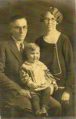
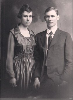
Lydia Olevene Myers Munster
| Birth | : | 6 Jan 1902 Howard, Elk County, Kansas, USA |
| Death | : | 29 Feb 1996 Carmichael, Sacramento County, California, USA |
| Burial | : | Lincoln Cemetery, Lincoln, Placer County, USA |
| Coordinate | : | 38.8864310, -121.3020500 |
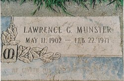
| Description | : | Lydia O. Munster died in Carmichael, February 29, 1996. Born January 6, 1902 in Howard, Kansas. Loving mother of Deloris Couchman of Carmichael and Robert W. Munster, Sr., of Newcastle. Adored grandmother of Robert W. Munster, Jr., and Kelley Munster. Preceeded in death by husband Lawrence G. Munster. Friends are invited to attend funeral services at 10:00 am, Wednesday, March 6, 1996, at Sierra View Funeral Chapel, 6201 Fair Oaks Blvd., Carmichael. Visitation 10 am to 7 pm Tuesday at the Chapel. Interment at Lincoln District Cemetery, Lincoln, Ca. Contributions may be... Read More |
frequently asked questions (FAQ):
-
Where is Lydia Olevene Myers Munster's memorial?
Lydia Olevene Myers Munster's memorial is located at: Lincoln Cemetery, Lincoln, Placer County, USA.
-
When did Lydia Olevene Myers Munster death?
Lydia Olevene Myers Munster death on 29 Feb 1996 in Carmichael, Sacramento County, California, USA
-
Where are the coordinates of the Lydia Olevene Myers Munster's memorial?
Latitude: 38.8864310
Longitude: -121.3020500
Family Members:
Parent
Spouse
Siblings
Flowers:
Nearby Cemetories:
1. Lincoln Cemetery
Lincoln, Placer County, USA
Coordinate: 38.8864310, -121.3020500
2. Santa Clara Memorial Park
Lincoln, Placer County, USA
Coordinate: 38.8894710, -121.3260560
3. Manzanita Cemetery
Lincoln, Placer County, USA
Coordinate: 38.9444008, -121.3032990
4. Whitney Family Mausoleum
Rocklin, Placer County, USA
Coordinate: 38.8256500, -121.2477000
5. Morgan Oaks Eternal Preserve
Lincoln, Placer County, USA
Coordinate: 38.9629050, -121.2860530
6. Gold Hill Cemetery
Gold Hill, Placer County, USA
Coordinate: 38.9025000, -121.1802200
7. Sheridan Cemetery
Sheridan, Placer County, USA
Coordinate: 38.9741000, -121.3585300
8. School House Park Cemetery
Roseville, Placer County, USA
Coordinate: 38.7893180, -121.3578670
9. Rocklin Cemetery
Rocklin, Placer County, USA
Coordinate: 38.7827670, -121.2337980
10. Newcastle Cemetery
Newcastle, Placer County, USA
Coordinate: 38.8708880, -121.1444060
11. Stewarts Flat Cemetery
Penryn, Placer County, USA
Coordinate: 38.8447360, -121.1507950
12. Roseville Public Cemetery District
Roseville, Placer County, USA
Coordinate: 38.7606010, -121.2707977
13. Shepherd of the Sierra Memorial Garden
Loomis, Placer County, USA
Coordinate: 38.7890800, -121.1944200
14. Boothill Cemetery
Roseville, Placer County, USA
Coordinate: 38.7598730, -121.2712130
15. Ophir Cemetery
Placer County, USA
Coordinate: 38.8928870, -121.1273790
16. Lone Star Cemetery
Placer County, USA
Coordinate: 38.9757996, -121.1380997
17. Camp Far West Cemetery
Wheatland, Yuba County, USA
Coordinate: 39.0395500, -121.3431400
18. Prosser Family Cemetery
Loomis, Placer County, USA
Coordinate: 38.8071900, -121.1285600
19. Mansur Family Cemetery
Loomis, Placer County, USA
Coordinate: 38.8139600, -121.1214000
20. Wheatland Cemetery
Wheatland, Yuba County, USA
Coordinate: 39.0083008, -121.4360962
21. New Auburn Cemetery
Auburn, Placer County, USA
Coordinate: 38.9026900, -121.0870800
22. Union Cemetery
Roseville, Placer County, USA
Coordinate: 38.7302600, -121.3924200
23. Old Auburn Cemetery
Auburn, Placer County, USA
Coordinate: 38.9023720, -121.0812230
24. Wells Cemetery
Auburn, Placer County, USA
Coordinate: 38.9667000, -121.1054900


