


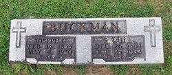
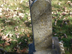
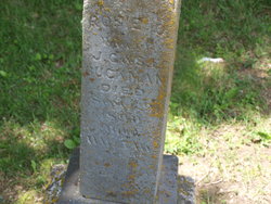
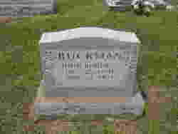
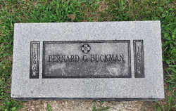
Sarah Elizabeth Spalding Buckman
| Birth | : | 26 Dec 1854 Monroe County, Missouri, USA |
| Death | : | 25 Oct 1932 Indian Creek, Monroe County, Missouri, USA |
| Burial | : | All Saints Churchyard, Woodchurch, Ashford Borough, England |
| Coordinate | : | 51.0807110, 0.7709980 |
| Plot | : | 09 - 09 |
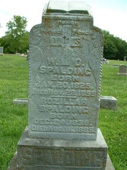
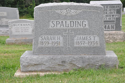
| Description | : | Sarah was the daughter of William David Spalding & Rozella Yates. She married Joseph Gregory Buckman on 23 November 1873 & they had 12 children. Sarah died of a stroke. |
frequently asked questions (FAQ):
-
Where is Sarah Elizabeth Spalding Buckman's memorial?
Sarah Elizabeth Spalding Buckman's memorial is located at: All Saints Churchyard, Woodchurch, Ashford Borough, England.
-
When did Sarah Elizabeth Spalding Buckman death?
Sarah Elizabeth Spalding Buckman death on 25 Oct 1932 in Indian Creek, Monroe County, Missouri, USA
-
Where are the coordinates of the Sarah Elizabeth Spalding Buckman's memorial?
Latitude: 51.0807110
Longitude: 0.7709980
Family Members:
Parent

Spouse
Siblings

Children

Flowers:


Nearby Cemetories:
1. All Saints Churchyard
Woodchurch, Ashford Borough, England
Coordinate: 51.0807110, 0.7709980
2. Ss Peter & Paul Churchyard
Shadoxhurst, Ashford Borough, England
Coordinate: 51.1044850, 0.8144740
3. St Mary's Churchyard
Kenardington, Ashford Borough, England
Coordinate: 51.0546000, 0.8164000
4. St. Mary the Virgin Churchyard
High Halden, Ashford Borough, England
Coordinate: 51.1028950, 0.7148620
5. St. Mary the Virgin Churchyard
Reading Street, Ashford Borough, England
Coordinate: 51.0431442, 0.7400970
6. Ebony Old Cemetery
Stone-cum-Ebony, Ashford Borough, England
Coordinate: 51.0378926, 0.7422129
7. St. Matthew Churchyard
Warehorne, Ashford Borough, England
Coordinate: 51.0575460, 0.8375700
8. St. Margaret's Churchyard
Bethersden, Ashford Borough, England
Coordinate: 51.1291440, 0.7538760
9. Unitarian Old Meeting House
Tenterden, Ashford Borough, England
Coordinate: 51.0717468, 0.6906880
10. St. Michael and All Angels Churchyard
Tenterden, Ashford Borough, England
Coordinate: 51.0867424, 0.6894140
11. St Mary the Virgin Churchyard
Orlestone, Ashford Borough, England
Coordinate: 51.0767000, 0.8539000
12. St Peter and St Paul Churchyard
Appledore, Ashford Borough, England
Coordinate: 51.0295660, 0.7903990
13. St. Mildred's Churchyard
Tenterden, Ashford Borough, England
Coordinate: 51.0686264, 0.6870960
14. Station Road Extension
Tenterden, Ashford Borough, England
Coordinate: 51.0686640, 0.6852830
15. St John the Baptist
Small Hythe, Ashford Borough, England
Coordinate: 51.0396260, 0.6996060
16. Tenterden Cemetery
Tenterden, Ashford Borough, England
Coordinate: 51.0676820, 0.6737140
17. St Mary the Virgin Churchyard
Stone-cum-Ebony, Ashford Borough, England
Coordinate: 51.0127980, 0.7645592
18. St. Mary the Virgin Churchyard
Great Chart, Ashford Borough, England
Coordinate: 51.1422350, 0.8285800
19. St. Dunstan Churchyard
Snargate, Shepway District, England
Coordinate: 51.0227100, 0.8371750
20. St. Mary Magdalene Churchyard
Ruckinge, Ashford Borough, England
Coordinate: 51.0654060, 0.8883300
21. St. Thomas à Becket Cemetery
Fairfield, Shepway District, England
Coordinate: 51.0043210, 0.7993930
22. St Augustine Church
Snave, Ashford Borough, England
Coordinate: 51.0334570, 0.8710390
23. Wittersham
Wittersham, Ashford Borough, England
Coordinate: 51.0115600, 0.7016000
24. St Enswith's Church
Brenzett, Shepway District, England
Coordinate: 51.0138510, 0.8573170