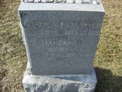
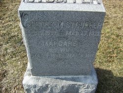
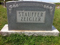
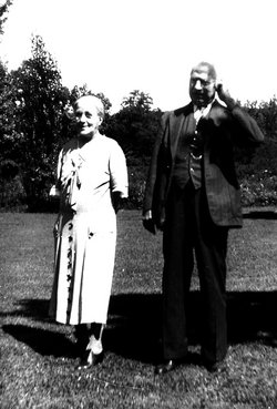
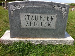
Margaret Kuhn Stouffer
| Birth | : | 8 May 1833 Hagerstown, Washington County, Maryland, USA |
| Death | : | 11 Mar 1912 Hagerstown, Washington County, Maryland, USA |
| Burial | : | St Mary Churchyard, Wiston, Horsham District, England |
| Coordinate | : | 50.8995280, -0.3582890 |
| Description | : | Margaret Stouffer was known to all her grandchildren as "Muzzie," and was dearly loved by her family. She and her husband, Henry, lived in the oldest house in Edgemont, built by the first Stouffer who migrated to Edgemont from Germany by way of Lancaster County. Margaret bore eight children: Clara, Alice, Charles "Ed", Mary Grace "Molly," Anna, John and Dillon. Margaret died in 1912 at the home of her daughter, Molly Tenney, in Hagerstown. they had moved from Edgemont the previous year. |
frequently asked questions (FAQ):
-
Where is Margaret Kuhn Stouffer's memorial?
Margaret Kuhn Stouffer's memorial is located at: St Mary Churchyard, Wiston, Horsham District, England.
-
When did Margaret Kuhn Stouffer death?
Margaret Kuhn Stouffer death on 11 Mar 1912 in Hagerstown, Washington County, Maryland, USA
-
Where are the coordinates of the Margaret Kuhn Stouffer's memorial?
Latitude: 50.8995280
Longitude: -0.3582890
Family Members:
Parent
Spouse
Siblings
Children
Flowers:
Nearby Cemetories:
1. St Mary Churchyard
Wiston, Horsham District, England
Coordinate: 50.8995280, -0.3582890
2. All Saints Churchyard
Wiston, Horsham District, England
Coordinate: 50.9132350, -0.3725910
3. St Andrew and St Cuthman Churchyard
Steyning, Horsham District, England
Coordinate: 50.8900700, -0.3250280
4. St Nicholas Churchyard
Bramber, Horsham District, England
Coordinate: 50.8828660, -0.3153580
5. St Mary's Churchyard Extension
Washington, Horsham District, England
Coordinate: 50.9036269, -0.4089782
6. St. Mary's Parish Churchyard
Washington, Horsham District, England
Coordinate: 50.9043450, -0.4103140
7. St Peter Churchyard
Upper Beeding, Horsham District, England
Coordinate: 50.8873530, -0.3056540
8. St James Churchyard
Ashurst, Horsham District, England
Coordinate: 50.9347992, -0.3273070
9. Worthing Crematorium
Findon, Arun District, England
Coordinate: 50.8728370, -0.4085170
10. St Botolph's
Boto By, Guldborgsund Kommune, Denmark
Coordinate: 50.8704488, -0.3049848
11. Botolph Cemetery
Steyning, Horsham District, England
Coordinate: 50.8698470, -0.3051070
12. Findon Cemetery
Findon, Arun District, England
Coordinate: 50.8678500, -0.4100500
13. St John the Baptist Churchyard
Findon, Arun District, England
Coordinate: 50.8650400, -0.4148790
14. Coombes Churchyard
Coombes, Adur District, England
Coordinate: 50.8611730, -0.3082180
15. Saint Marys Churchyard
Sullington, Horsham District, England
Coordinate: 50.9070090, -0.4391640
16. Holy Sepulchre Churchyard
Warminghurst, Horsham District, England
Coordinate: 50.9402980, -0.4113760
17. St. Mary's Churchyard
Thakeham, Horsham District, England
Coordinate: 50.9446420, -0.4213350
18. St. Mary's Churchyard
Sompting, Adur District, England
Coordinate: 50.8386030, -0.3518740
19. St Peter's Churchyard
Henfield, Horsham District, England
Coordinate: 50.9323340, -0.2762030
20. Lancing and Sompting Cemetery
Lancing, Adur District, England
Coordinate: 50.8405270, -0.3280020
21. Henfield Cemetery
Henfield, Horsham District, England
Coordinate: 50.9342000, -0.2764400
22. Landing College Chapel
Lancing, Adur District, England
Coordinate: 50.8459798, -0.3042240
23. St. Mary's Churchyard
Storrington, Horsham District, England
Coordinate: 50.9160360, -0.4566160
24. Durrington Cemetery
Durrington, Worthing Borough, England
Coordinate: 50.8390820, -0.3934460

