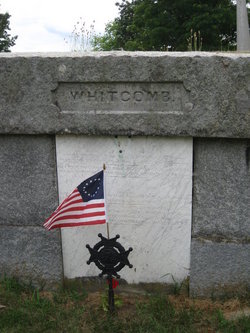
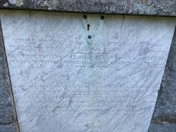
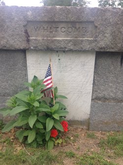
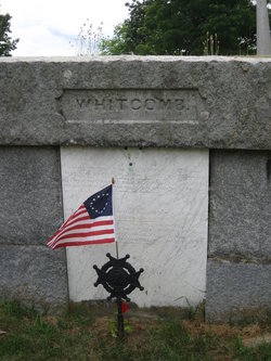
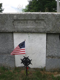
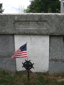
Mercy Priest Whitcomb
| Birth | : | 25 May 1778 Harvard, Worcester County, Massachusetts, USA |
| Death | : | 1 Feb 1849 Harvard, Worcester County, Massachusetts, USA |
| Burial | : | Pine Creek Methodist Cemetery, Pine Furnace, Armstrong County, USA |
| Coordinate | : | 40.8497870, -79.4309590 |
frequently asked questions (FAQ):
-
Where is Mercy Priest Whitcomb's memorial?
Mercy Priest Whitcomb's memorial is located at: Pine Creek Methodist Cemetery, Pine Furnace, Armstrong County, USA.
-
When did Mercy Priest Whitcomb death?
Mercy Priest Whitcomb death on 1 Feb 1849 in Harvard, Worcester County, Massachusetts, USA
-
Where are the coordinates of the Mercy Priest Whitcomb's memorial?
Latitude: 40.8497870
Longitude: -79.4309590
Family Members:
Parent
Spouse
Siblings
Children
Flowers:
Nearby Cemetories:
1. Pine Creek Methodist Cemetery
Pine Furnace, Armstrong County, USA
Coordinate: 40.8497870, -79.4309590
2. Lower Piney Cemetery
Armstrong County, USA
Coordinate: 40.8655920, -79.4395400
3. Mount Union Davis Cemetery
Armstrong County, USA
Coordinate: 40.8323850, -79.4236530
4. Pine Creek Baptist Church Cemetery
Kittanning, Armstrong County, USA
Coordinate: 40.8514748, -79.4601440
5. Mount Zion Presbyterian Cemetery
Boggs Township, Armstrong County, USA
Coordinate: 40.8717100, -79.4171980
6. Mateer Cemetery
Armstrong County, USA
Coordinate: 40.8721000, -79.4175000
7. Scott Fox Memorial Site
Kittanning, Armstrong County, USA
Coordinate: 40.8457580, -79.3972170
8. Ritchison Farm Cemetery
Armstrong County, USA
Coordinate: 40.8475000, -79.4747000
9. Good Shepherd Cemetery
Fenelton, Butler County, USA
Coordinate: 40.8434590, -79.4741510
10. Calhoun Cemetery
Armstrong County, USA
Coordinate: 40.8502426, -79.3848648
11. Cochran Cemetery
Templeton, Armstrong County, USA
Coordinate: 40.8941994, -79.4582977
12. Myers-Patton Cemetery
Adrian, Armstrong County, USA
Coordinate: 40.8619270, -79.4972458
13. County Home Cemetery
Armstrong County, USA
Coordinate: 40.8114710, -79.4842390
14. Salem United Church of Christ Cemetery
Kittanning, Armstrong County, USA
Coordinate: 40.8244130, -79.3559970
15. Simpson Church Cemetery
Kittanning, Armstrong County, USA
Coordinate: 40.7899000, -79.4083640
16. Saint Joseph Cemetery
Kittanning, Armstrong County, USA
Coordinate: 40.8266983, -79.5074997
17. Rehobeth Reformed Presbyterian Church Cemetery
Kittanning, Armstrong County, USA
Coordinate: 40.8922670, -79.3695690
18. Rupp Lutheran Church Cemetery
Kittanning, Armstrong County, USA
Coordinate: 40.7866516, -79.4561920
19. Elgin-Old Presbyterian Cemetery
Rural Valley, Armstrong County, USA
Coordinate: 40.8046646, -79.3662949
20. Croyle Cemetery
Adrian, Armstrong County, USA
Coordinate: 40.8782997, -79.5108032
21. Kittanning Cemetery
Kittanning, Armstrong County, USA
Coordinate: 40.8231140, -79.5174340
22. John Cemetery
Frenchs Corners, Armstrong County, USA
Coordinate: 40.9003296, -79.4978409
23. Saint Marys Cemetery
Kittanning, Armstrong County, USA
Coordinate: 40.8347015, -79.5239029
24. Pleasant Union Cemetery
Cowanshannock Township, Armstrong County, USA
Coordinate: 40.8314018, -79.3350449

