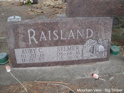
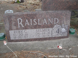
Selmer Raisland
| Birth | : | 14 Aug 1916 Big Timber, Sweet Grass County, Montana, USA |
| Death | : | 31 Aug 1996 Big Timber, Sweet Grass County, Montana, USA |
| Burial | : | Oakwood Cemetery, Stryker, Williams County, USA |
| Coordinate | : | 41.4978900, -84.4274700 |
| Plot | : | Section 6, Block 65, Lot 2, Grave 8 |
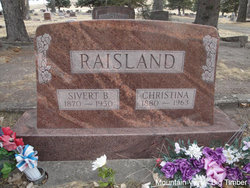
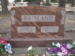
| Description | : | : Big Timber Pioneer, September 6, 1996 Selmer Raisland, 80, passed away Saturday night, August 31, 1996, in the Pioneer Medical Center in Big Timber of a massive heart attack. He was born August 14, 1916, on the family ranch at Wildcat near Big Timber to Sivert and Christina Raisland. He married Ruby Cubbison on July 31, 1937. He worked and lived in Sweet Grass County and the surrounding area all of his life, sheepherding, being his specialty in the early years. He continued to fulfill his retirement years by restoring old sheep wagons. He enjoyed spending time with his... Read More |
frequently asked questions (FAQ):
-
Where is Selmer Raisland's memorial?
Selmer Raisland's memorial is located at: Oakwood Cemetery, Stryker, Williams County, USA.
-
When did Selmer Raisland death?
Selmer Raisland death on 31 Aug 1996 in Big Timber, Sweet Grass County, Montana, USA
-
Where are the coordinates of the Selmer Raisland's memorial?
Latitude: 41.4978900
Longitude: -84.4274700
Family Members:
Parent
Spouse
Siblings
Flowers:
Nearby Cemetories:
1. Oakwood Cemetery
Stryker, Williams County, USA
Coordinate: 41.4978900, -84.4274700
2. French Cemetery
Springfield Township, Williams County, USA
Coordinate: 41.5039100, -84.4485500
3. Boynton Cemetery
Stryker, Williams County, USA
Coordinate: 41.4782982, -84.4389038
4. Bodel Cemetery
Stryker, Williams County, USA
Coordinate: 41.5277080, -84.4495600
5. Beaver Creek Cemetery
Williams County, USA
Coordinate: 41.4808006, -84.4858017
6. Lockport Cemetery
Stryker, Williams County, USA
Coordinate: 41.5466690, -84.3927765
7. Old Pulaski Cemetery
Williams County, USA
Coordinate: 41.5135994, -84.5119019
8. Shiffler Cemetery
Jefferson Township, Williams County, USA
Coordinate: 41.5325012, -84.5063934
9. Kunkle Cemetery
Williams County, USA
Coordinate: 41.5561150, -84.4762400
10. Buck Cemetery
Williams County, USA
Coordinate: 41.4272003, -84.4250031
11. Goll Cemetery
Archbold, Fulton County, USA
Coordinate: 41.5558014, -84.3677979
12. Floral Grove Cemetery
West Unity, Williams County, USA
Coordinate: 41.5708008, -84.4158020
13. Zion Cemetery
Williams County, USA
Coordinate: 41.4417000, -84.3628006
14. Williams County Infirmary Cemetery
West Unity, Williams County, USA
Coordinate: 41.5571430, -84.5097860
15. Reform Cemetery
Archbold, Fulton County, USA
Coordinate: 41.5039790, -84.3061070
16. Archbold Cemetery
Archbold, Fulton County, USA
Coordinate: 41.5028000, -84.3058014
17. Evansport Cemetery
Evansport, Defiance County, USA
Coordinate: 41.4075012, -84.3964005
18. Beatty Cemetery
West Unity, Williams County, USA
Coordinate: 41.5881970, -84.3954710
19. Rings Cemetery
West Unity, Williams County, USA
Coordinate: 41.5928680, -84.4288400
20. Fountain Grove Cemetery
Bryan, Williams County, USA
Coordinate: 41.4572182, -84.5480576
21. Saint John Lutheran Church Cemetery
Ridgeville Township, Henry County, USA
Coordinate: 41.4425410, -84.3084650
22. Johnson Cemetery
Burlington, Fulton County, USA
Coordinate: 41.5791230, -84.3308020
23. Beaver Creek Cemetery
West Unity, Williams County, USA
Coordinate: 41.6011009, -84.4738998
24. Bistline Cemetery
West Unity, Williams County, USA
Coordinate: 41.5995650, -84.4909490

