

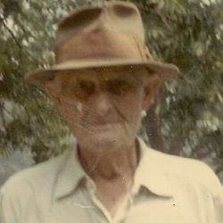
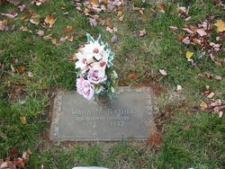
Marvin Burroughs Rather
| Birth | : | 6 Apr 1915 Harford County, Maryland, USA |
| Death | : | 11 Aug 1988 Harford County, Maryland, USA |
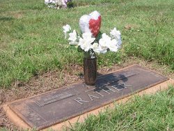
| Burial | : | St Olave Churchyard, Fritwell, Cherwell District, England |
| Coordinate | : | 51.9596980, -1.2381180 |
| Plot | : | Christus 74-B-3 |
frequently asked questions (FAQ):
-
Where is Marvin Burroughs Rather's memorial?
Marvin Burroughs Rather's memorial is located at: St Olave Churchyard, Fritwell, Cherwell District, England.
-
When did Marvin Burroughs Rather death?
Marvin Burroughs Rather death on 11 Aug 1988 in Harford County, Maryland, USA
-
Where are the coordinates of the Marvin Burroughs Rather's memorial?
Latitude: 51.9596980
Longitude: -1.2381180
Family Members:
Parent
Spouse
Siblings

Children


Nearby Cemetories:
1. St Olave Churchyard
Fritwell, Cherwell District, England
Coordinate: 51.9596980, -1.2381180
2. Fritwell Parish Council Cemetery
Fritwell, Cherwell District, England
Coordinate: 51.9599490, -1.2380650
3. Fewcott All Saints Churchyard
Albury, South Oxfordshire District, England
Coordinate: 51.9477100, -1.2170700
4. St Mary the Virgin Churchyard
Souldern, Cherwell District, England
Coordinate: 51.9808600, -1.2399900
5. St. Mary's Churchyard
Ardley, Cherwell District, England
Coordinate: 51.9422140, -1.2122580
6. St James Churchyard
Somerton, Cherwell District, England
Coordinate: 51.9539990, -1.2786200
7. St Michael Churchyard
Aynho, South Northamptonshire Borough, England
Coordinate: 51.9936080, -1.2522380
8. St Peters Churchyard
Stoke Lyne, Cherwell District, England
Coordinate: 51.9505340, -1.1771680
9. St Marys Churchyard
North Aston, Cherwell District, England
Coordinate: 51.9562960, -1.3020350
10. Upper Heyford Cemetery
Upper Heyford, Cherwell District, England
Coordinate: 51.9294701, -1.2808000
11. St Marys Churchyard
Upper Heyford, Cherwell District, England
Coordinate: 51.9290710, -1.2819670
12. All Saints Churchyard
Croughton, South Northamptonshire Borough, England
Coordinate: 51.9977370, -1.2065760
13. St Peter's Churchyard
Bucknell, Cherwell District, England
Coordinate: 51.9263400, -1.1861700
14. Croughton Cemetery
Croughton, South Northamptonshire Borough, England
Coordinate: 52.0014880, -1.2031960
15. St Mary the Virgin Churchyard
Hardwick, Cherwell District, England
Coordinate: 51.9616750, -1.1615570
16. SS Peter and Paul Churchyard
Steeple Aston, Cherwell District, England
Coordinate: 51.9311350, -1.3091000
17. St Mary Churchyard
Lower Heyford, Cherwell District, England
Coordinate: 51.9202580, -1.2960220
18. All Saints Churchyard
Middleton Stoney, Cherwell District, England
Coordinate: 51.9053470, -1.2295300
19. Ss Peter and Paul Churchyard
Deddington, Cherwell District, England
Coordinate: 51.9817680, -1.3207470
20. Holy Trinity Churchyard
Hethe, Cherwell District, England
Coordinate: 51.9615600, -1.1452100
21. St. Mary's Churchyard
Cottisford, Cherwell District, England
Coordinate: 51.9749070, -1.1464410
22. Kings Sutton Cemetery
Kings Sutton, South Northamptonshire Borough, England
Coordinate: 52.0151400, -1.2711000
23. St Mary Magdelene Churchyard
Duns Tew, Cherwell District, England
Coordinate: 51.9528350, -1.3363090
24. St Leonard and St James Churchyard
Rousham, West Oxfordshire District, England
Coordinate: 51.9139780, -1.3037790